Ágasegyháza
Place in Bács-Kiskun, Hungary

Coat of arms
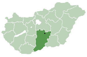
 Hungary
 (2001)
6076
Ágasegyháza is a village and municipality in Bács-Kiskun county, in the Southern Great Plain region of southern Hungary.
Name
The village's name originates from the old Hungarian personal name Agus. This may came from the noun ág ('branch'), or was more likely a variation of Ákos. This way it would mean 'the temple of Ákos'. In 1353, 1353 and 1429, the village was recorded as Agaseghaz.[1]
Geography
It covers an area of 55.87 km2 (22 sq mi) and has a population of 1920 people. The village has a population density of 34.47 km (21 mi).
The village's post code is 6076 and the area code is 76.
References
- ^ Kiss, Lajos (1980). Földrajzi nevek etimológiai szótára. Budapest: Akadémiai Kiadó. ISBN 963-05-2277-2.
- v
- t
- e
- Kecskemét (county seat)


- Ágasegyháza
- Akasztó
- Apostag
- Bácsborsód
- Bácsszentgyörgy
- Bácsszőlős
- Ballószög
- Balotaszállás
- Bátmonostor
- Bátya
- Bócsa
- Borota
- Bugacpusztaháza
- Császártöltés
- Csátalja
- Csávoly
- Csengőd
- Csikéria
- Csólyospálos
- Dávod
- Drágszél
- Dunaegyháza
- Dunafalva
- Dunaszentbenedek
- Dunatetétlen
- Dusnok
- Érsekcsanád
- Érsekhalma
- Fajsz
- Felsőlajos
- Felsőszentiván
- Foktő
- Fülöpháza
- Fülöpjakab
- Fülöpszállás
- Gara
- Gátér
- Géderlak
- Harkakötöny
- Helvécia
- Hercegszántó
- Homokmégy
- Imrehegy
- Jakabszállás
- Jászszentlászló
- Kaskantyú
- Katymár
- Kelebia
- Kéleshalom
- Kisszállás
- Kömpöc
- Kunadacs
- Kunbaja
- Kunbaracs
- Kunfehértó
- Kunpeszér
- Kunszállás
- Ladánybene
- Madaras
- Mátételke
- Miske
- Móricgát
- Nagybaracska
- Nemesnádudvar
- Nyárlőrinc
- Ordas
- Öregcsertő
- Orgovány
- Páhi
- Pálmonostora
- Petőfiszállás
- Pirtó
- Rém
- Soltszentimre
- Szakmár
- Szalkszentmárton
- Szank
- Szentkirály
- Szeremle
- Tabdi
- Tass
- Tataháza
- Tázlár
- Tiszaug
- Újsolt
- Újtelek
- Uszód
- Városföld
- Vaskút
- Zsana
46°50′N 19°27′E / 46.833°N 19.450°E / 46.833; 19.450
 | This Bács-Kiskun location article is a stub. You can help Wikipedia by expanding it. |
- v
- t
- e


