Ab Khuda'i
Village in Herat, Afghanistan
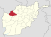
34°54′N 62°42′E / 34.9°N 62.7°E / 34.9; 62.7[1]Ab Khuda'i or Abzi Khuda'i[2] is a village in the west of Ab Kamari District in Herat Province, of north-west Afghanistan. Its population, consists of approximately 90% Tajik with a small Pashtun, Aimaq and Uzbek minority. Other localities include Alkhan, Anjir, Duzdanak, Gana Gul, Khalifa, and Papal. The village used to be in Badghis Province.[3]
References
- ^ "Afg: Badghis Province - Reference Map | HumanitarianResponse". www.humanitarianresponse.info. Retrieved 6 September 2020.
- ^ Latitude.to. "GPS coordinates of Ab Khuda'i, Afghanistan. Latitude: 35.2710 Longitude: 63.6830". Latitude.to, maps, geolocated articles, latitude longitude coordinate conversion. Retrieved 8 October 2020.
- ^ "Baghdis Province Land Cover Map" (PDF). ucdavis.edu. AIMS. 2002.[permanent dead link]
- v
- t
- e
Badghis Province
Capital: Qala i Naw
- Ab Bakhsh
- Ab Khuda'i
- Ab Khvor
- Ab-e Barik-e Qowdi
- Abshar
- ʽAli Gol
- Babula'i
- Bahador Khani
- Bahadorkhan
- Bala Bowkan
- Bala Murghab
- Bayah
- Baybacheh
- Bazartu
- Bidak
- Bozba'i
- Chakav
- Chaman-e Bid
- Cheshmeh-ye Duzakh
- Cheshmeh-ye Yanbolaq
- Dahan-e Koklan
- Darreh-ye Bum
- Darreh-ye Joval
- Deh Berenj Qalʽeh
- Dehestan
- Galleh Chaghar
- Gelak
- Gharmeh
- Jawand
- Jowkar
- Kariz-e Zaman-e Bala
- Kariz-e Zaman-e Kalgandi
- Kariz-e Zaman-e Pa'in
- Khar Bid
- Kheyr Khaneh
- Khvajeh Qalandar
- Khvosh Asia
- Khvosh Margh
- Koshk-e Kohneh
- Kowkcha'il
- Kucheh-ye Zard
- Mangan
- Miranza'i
- Murichaq
- Pa'in Bowkan
- Padeh-ye Laghari
- Padeh-ye Nowkdari
- Qades
- Qalʽeh-ye Niaz
- Qalʽeh-ye Nowak
- Qalʽeh-ye Vali
- Qala e Naw (Capital)
- Qeshlaq Khas
- Robat
- Sakhari
- Sangbor
- Seh Kushk
- Senjetak
- Shahr-e Arman
- Shorshoreh
- Tagab Robat
- Takht-e Ghowrmach
 | This Badghis Province, Afghanistan location article is a stub. You can help Wikipedia by expanding it. |
- v
- t
- e


