Aura River (Finland)
River in Finland
| Aura River | |
|---|---|
 Aura River in central Turku | |
| Location | |
| Country | Finland |
| Physical characteristics | |
| Source | |
| • location | Oripää |
| Mouth | |
• location | Turku |
| Length | 70 km (43 mi) |
| Basin size | 885 km2 (342 sq mi) |
| Discharge | |
| • average | 7 m3/s (250 cu ft/s) |
The Aura River (Finnish Aurajoki; Swedish Aura å) is a river in south-western Finland. It originates in Oripää, and it flows through Pöytyä, Aura and Lieto before discharging into the Archipelago Sea in the middle of the city of Turku. The waters of the Aura river are brown. The total length of the river is about 70 kilometres (43 mi), and it contains eleven rapids, the biggest of which is Nautelankoski at Lieto. The reserve tap water for Turku Region is drawn from the Aura, the city's secondary waterworks being situated by the Halinen rapids.[1]
The word "Aura" appears to come from an archaic Swedish word for waterway (aathra, which is still current in the form ådra), but in Finnish it translates as "plough," a name the river lives up to.[2] Situated in an agricultural zone, it is made turbid by surface runoff from nearby farms with eutrophication as the biggest threat. Its condition has been improving since the 1970s and the Aura river is now clean enough to support salmon.
The banks of the river have been inhabited for at least 6,000 years. The area is notable for the cultural heritage in Finland. The archdiocese of Finland has been situated near the river since the thirteenth century.
Gallery
-
![Wintery View Downstream from Aura Bridge by Johan Jakob Reinberg [fi], c. 1880](//upload.wikimedia.org/wikipedia/commons/thumb/d/d9/Johan_Jakob_Reinberg_-_Wintery_View_Downstream_from_Aura_Bridge_.jpg/311px-Johan_Jakob_Reinberg_-_Wintery_View_Downstream_from_Aura_Bridge_.jpg) Wintery View Downstream from Aura Bridge by Johan Jakob Reinberg [fi], c. 1880
Wintery View Downstream from Aura Bridge by Johan Jakob Reinberg [fi], c. 1880 -
 View of Turku by Reinberg in 1893
 -
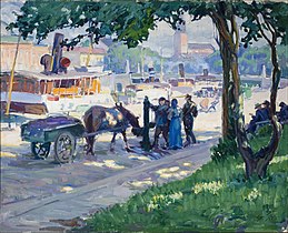 View from the Bank of Aura River by Santeri Salokivi in 1913
![Wintery View Downstream from Aura Bridge by Johan Jakob Reinberg [fi], c. 1880](http://upload.wikimedia.org/wikipedia/commons/thumb/d/d9/Johan_Jakob_Reinberg_-_Wintery_View_Downstream_from_Aura_Bridge_.jpg/311px-Johan_Jakob_Reinberg_-_Wintery_View_Downstream_from_Aura_Bridge_.jpg)


See also
References
Wikimedia Commons has media related to Aura river.
| Authority control databases |
|
|---|
60°39′44″N 22°35′27″E / 60.66222°N 22.59083°E / 60.66222; 22.59083
- v
- t
- e
This article related to a river in Finland is a stub. You can help Wikipedia by expanding it. |
- v
- t
- e


