Bayındır
District and municipality in İzmir, Turkey
38°13′09″N 27°38′53″E / 38.21917°N 27.64806°E / 38.21917; 27.64806 (2022)[1]
35840
Bayındır is a municipality and district of İzmir Province, Turkey.[2] Its area is 548 km2,[3] and its population is 40,073 (2022).[1] The central town of the district is situated in the valley of the Küçük Menderes.[4]
History
Its name in classical antiquity was Caystrus (Κάϋστρος), near Smyrna. Its present name derives from Turkish people who in the 11th c. AD settled there; they were members of the Bayındır clan, one of the 24 original Oghuz clans. From 1867 until 1922, Bayındır was part of the Aydin Vilayet of the Ottoman Empire. In 1997, the town population was 18,100. It is connected with İzmir by a branch of the Aydın railway, and has a trade in olives, olive oil, cotton, figs, raisins and tobacco.[4]
Composition
There are 59 neighbourhoods in Bayındır District:[5]
- Alankıyı
- Alanköy
- Arıkbaşı
- Atatürk
- Balcılar
- Bıyıklar
- Buruncuk
- Cami
- Çamlıbel
- Çenikler
- Çiftçigediği
- Çınar
- Çınardibi
- Çırpı Cami
- Cumhuriyet
- Demircilik
- Dereköy
- Dernekli
- Elifli
- Ergenli
- Fatih
- Fırınlı
- Gaziler
- Hacıbeşir
- Hacıibrahim
- Hasköy
- Hatay
- Havuzbaşı
- Hisarlık
- İbrahimçavuş
- Kabaağaç
- Karahalilli
- Karahayit
- Karapınar
- Karaveliler
- Kızılcaağaç
- Kızılcaova
- Kızılkeçili
- Kızıloba
- Kurt
- Lütuflar
- Mektep
- Mitatpaşa
- Necati Uza
- Orta
- Osmanlar
- Pınarlı
- Sadıkpaşa
- Sarıyurt
- Söğütören
- Tokatbaşı
- Turan
- Yakacık
- Yakapınar
- Yeni
- Yenice
- Yeşilova
- Yusuflu
- Zeytinova
Transport
The district is crossed by the Torbalı-Tire railway, with a branch to Ödemiş. It is served by regional trains from/to İzmir (Basmane-Ödemiş and Basmane-Tire), and counts the stations of Arıkbaşı, Karpuzlu, Elifli, Furunlu, Bayındır (in the capital town), Yakaköy and Çatal.[6]
References
- ^ a b "Address-based population registration system (ADNKS) results dated 31 December 2022, Favorite Reports" (XLS). TÜİK. Retrieved 12 July 2023.
- ^ Büyükşehir İlçe Belediyesi, Turkey Civil Administration Departments Inventory. Retrieved 12 July 2023.
- ^ "İl ve İlçe Yüz ölçümleri". General Directorate of Mapping. Retrieved 12 July 2023.
- ^ a b Chisholm, Hugh, ed. (1911). "Baindir" . Encyclopædia Britannica. Vol. 3 (11th ed.). Cambridge University Press. p. 223.
- ^ Mahalle, Turkey Civil Administration Departments Inventory. Retrieved 12 July 2023.
- ^ 1841223
(x a j h)Bayındır on OpenStreetMap
External links
![]() Media related to Bayındır at Wikimedia Commons
Media related to Bayındır at Wikimedia Commons
- v
- t
- e
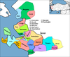
Bayındır in Izmir Province of Turkey

| Istanbul | |
|---|---|
| West Marmara | |
| Aegean | |
| East Marmara | |
| West Anatolia | |
| Mediterranean | |
| Central Anatolia | |
| West Black Sea | |
| East Black Sea | |
| Northeast Anatolia | |
| Central East Anatolia | |
| Southeast Anatolia | |
Metropolitan municipalities are bolded.
Authority control databases | |
|---|---|
| International |
|
| National |
|
 | This geographical article about a location in İzmir Province, Turkey is a stub. You can help Wikipedia by expanding it. |
- v
- t
- e


