Berdavan, Armenia
You can help expand this article with text translated from the corresponding article in Armenian. (October 2021) Click [show] for important translation instructions.
- View a machine-translated version of the Armenian article.
- Machine translation, like DeepL or Google Translate, is a useful starting point for translations, but translators must revise errors as necessary and confirm that the translation is accurate, rather than simply copy-pasting machine-translated text into the English Wikipedia.
- Do not translate text that appears unreliable or low-quality. If possible, verify the text with references provided in the foreign-language article.
- You must provide copyright attribution in the edit summary accompanying your translation by providing an interlanguage link to the source of your translation. A model attribution edit summary is
Content in this edit is translated from the existing Armenian Wikipedia article at [[:hy:Բերդավան]]; see its history for attribution. - You may also add the template
{{Translated|hy|Բերդավան}}to the talk page. - For more guidance, see Wikipedia:Translation.
41°12′10″N 45°00′12″E / 41.20278°N 45.00333°E / 41.20278; 45.00333
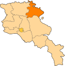
Place in Tavush, Armenia
Berdavan Բերդավան | |
|---|---|
 A view of Berdavan | |
  Berdavan  Berdavan | |
| Coordinates: 41°12′10″N 45°00′12″E / 41.20278°N 45.00333°E / 41.20278; 45.00333 | |
| Country | Armenia |
| Province | Tavush |
| Municipality | Noyemberyan |
| Government | |
| Population (2011)[1] | |
| • Total | 2,987 |
| Time zone | UTC+4 (AMT) |
| Berdavan, Armenia at GEOnet Names Server | |
Berdavan (Armenian: Բերդավան) is a village on the Kolb River in the Noyemberyan Municipality of the Tavush Province of Armenia. The village is located about 2 km north of the town of Noyemberyan, and near the villages of Dovekh, Koghb and Zorakan. Berdavan Fortress is located on a nearby hilltop.
Toponymy
Historically, the village was called Tkhadzor, then Ghalacha, and in 1978 it was renamed Berdavan.
History
The village of Ghalacha was relocated in 1893 – 1900. The relocation was due to the presence of mosquitos which were thought to bring malaria, but at the new site there were problems with access to drinking water.[citation needed] The school in Ghalacha was opened in 1906, after a period when there were no official schools in the area.[citation needed]
During the Second World War, Berdavan lost more than half of its male population, and during the First Nagorno-Karabakh War the village was heavily shelled. The village has a monument dedicated to the people who died in World War II.
Gallery
-
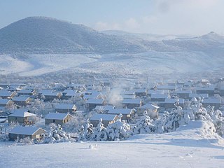 Berdavan in winter
 -
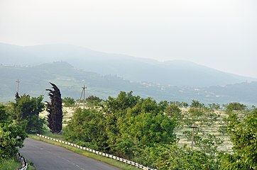 Scenery around the village
 -
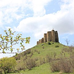 Berdavan Fortress
 -
 St. Nshan Church near Berdavan


References
- ^ Statistical Committee of Armenia. "The results of the 2011 Population Census of Armenia" (PDF).
External links
Wikimedia Commons has media related to Berdavan, Tavush.
- Report of the results of the 2001 Armenian Census, Statistical Committee of Armenia
- v
- t
- e

Capital: Ijevan
Portal:
 Geography


