Chilean Sea
Portion of the Pacific Ocean lying west of the Chilean mainland

Exclusive economic zone
continental platform
Presencial sea
The Chilean Sea is the portion of the Pacific Ocean lying west of the Chilean mainland. The official Chilean usage for Chilean Sea was defined on 30 May 1974 when the Diario oficial de la Republica de Chile published Supreme Decree #346, which declared that "the waters surrounding or touching the shores of the national territory shall be known as Mar Chileno."[1]
The Chilean Sea contains significant amounts of phosphorite and manganese-iron nodules, which may be potential targets for future seafloor mining.[2]
Presencial sea
The face sea, or heritage safeguard sea, is the maritime space that a certain coastal country demarcates, after an oceanopolitical appreciation, in order to indicate to third parties its zone of influence in the high seas adjacent to its exclusive economic zone, where its interests were or could be directly involved.
Without claims of sovereignty, by making a delimitation that includes the effective occupation of the high seas contiguous to its respective oceanic territory, the coastal state shows the interest in preserving said area from abusive uses or from certain activities that, due to its proximity, may affect the marine resources that inhabit its waters, especially, guarding the highly migratory straddling fishery resources from predation, and pollution of the marine habitat.
EEZ of Chile

Chile's EEZ includes areas around the Desventuradas Islands, Easter Island and the Juan Fernández Islands.
| Region | EEZ Area (km2)[3] | Land area | Total |
|---|---|---|---|
| Mainland | 1,975,760 | 755 757 | 2,731,517 |
| Desventuradas | 449 836 | 5 | 449 841 |
| Easter | 720 412 | 164 | 720 576 |
| Juan Fernandez | 502 524 | 100 | 502 624 |
| Total | 3,648,532 | 755 921 | 4,404,453 |
Gallery
-
 The Ferdinand Magellan's Nao Replica in the Museo Nao Victoria in Punta Arenas Chile, the first ship to sail it
 -
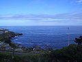 The Chilean Sea
 -
 A dusky dolphin


See also
- Borde costero
- Maritime history of Chile
- Insular Chile
- Islands of Chile
- Tricontinental Chile
- Chilean Antarctic Territory
- Geography of Chile
- Chilean–Peruvian maritime dispute
- Pacific Islands Forum
- Easter Island
- Exclusive economic zone of Chile
- Mar presencial
- Mar presencial de Chile
- Mar argentino
- Tesis del mar de resguardo patrimonial de Argentina
- Espacio marítimo argentino
- Mar de Grau
References
- ^ "Decreto 346: "Denomina Mar Chileno a las aguas del mar que bañan el territorio nacional"". Ministry of Foreign Affairs. 4 June 1974. Retrieved 11 December 2012.
- ^ García, Marcelo; Correa, Jorge; Maksaev, Víctor; Townley, Brian (2020). "Potential mineral resources of the Chilean offshore: an overview" (PDF). Andean Geology. 47 (1): 1–13. doi:10.5027/andgeoV47n1-3260.
- ^ See Around Us Project (n.d.). "Exclusive Economic Zones (EEZ)". Retrieved 3 June 2015.
EEZ waters of: Chile 1,975,760 km², Desventuradas Isl. 449,836 km², Easter Isl. 720,412 km², J. Fernandez, Felix and Ambrosio Isl. 502,524 km²
- v
- t
- e
- Adriatic Sea
- Aegean Sea
- Alboran Sea
- American Mediterranean Sea
- Archipelago Sea
- Argentine Sea
- Baffin Bay
- Balearic Sea
- Baltic Sea
- Bay of Biscay
- Bay of Bothnia
- Bay of Campeche
- Bay of Fundy
- Black Sea
- Bothnian Sea
- Caribbean Sea
- Celtic Sea
- English Channel
- Foxe Basin
- Greenland Sea
- Gulf of Bothnia
- Gulf of Finland
- Gulf of Lion
- Gulf of Guinea
- Gulf of Maine
- Gulf of Mexico
- Gulf of Saint Lawrence
- Gulf of Sidra
- Gulf of Venezuela
- Hudson Bay
- Ionian Sea
- Irish Sea
- Irminger Sea
- James Bay
- Labrador Sea
- Levantine Sea
- Libyan Sea
- Ligurian Sea
- Marmara Sea
- Mediterranean Sea
- Myrtoan Sea
- North Sea
- Norwegian Sea
- Sargasso Sea
- Sea of Åland
- Sea of Azov
- Sea of Crete
- Sea of the Hebrides
- Thracian Sea
- Tyrrhenian Sea
- Wadden Sea
- Arafura Sea
- Bali Sea
- Banda Sea
- Bering Sea
- Bismarck Sea
- Bohai Sea
- Bohol Sea
- Camotes Sea
- Celebes Sea
- Chilean Sea
- Coral Sea
- East China Sea
- Gulf of Alaska
- Gulf of Anadyr
- Gulf of California
- Gulf of Carpentaria
- Gulf of Fonseca
- Gulf of Panama
- Gulf of Thailand
- Gulf of Tonkin
- Halmahera Sea
- Java Sea
- Koro Sea
- Mar de Grau
- Molucca Sea
- Moro Gulf
- Philippine Sea
- Salish Sea
- Savu Sea
- Sea of Japan
- Sea of Okhotsk
- Seram Sea
- Seto Inland Sea
- Shantar Sea
- Sibuyan Sea
- Solomon Sea
- South China Sea
- Sulu Sea
- Tasman Sea
- Visayan Sea
- Yellow Sea
 Oceans portal
 Category


23°00′S 70°45′W / 23.000°S 70.750°W / -23.000; -70.750


