Ellenwood, Georgia
Unincorporated Community in Georgia, United States
33°36′36″N 84°17′17″W / 33.61000°N 84.28806°W / 33.61000; -84.2880630294
Ellenwood is an unincorporated community in Clayton, Henry, Rockdale and DeKalb counties in the U.S. state of Georgia. The community is a southeast suburb of Atlanta and is located along Interstate 675 and Georgia State Route 42. With a population of 46,967 and ten constituent neighborhoods, Ellenwood is the 19th largest community in Georgia.[2]
Ellenwood has a post office with ZIP code 30294.[3]
History
Ellenwood was first inhabited in 1830 by freed slaves from Henry County. It was incorporated in 1966 and its name is derived from the Ellenwood Plantation, which was settled in the 19th century and was owned by Colonel John H. Ellenwood. The plantation was one of the largest in the area, but was destroyed during the civil war by union troops, being rebuilt by the family later on.[4]
Government and infrastructure
The Atlanta Federal Records Center of the National Archives is in Ellenwood.[5]
Transit systems
MARTA serves the suburb.
Notable people
Justin Shaffer (born 1998), NFL player
References
- ^ "Ellenwood". Geographic Names Information System. United States Geological Survey, United States Department of the Interior.
- ^ "Neighborhood Scout". Neighborhood Scout. July 1, 2022. Retrieved July 1, 2022.
- ^ United States Postal Service. "USPS - Look Up a ZIP Code". Retrieved May 15, 2015.
- ^ "Ellenwood Towing | Ellenwood". Ellenwood Towing. Retrieved November 9, 2023.
- ^ "Atlanta Federal Records Center." National Archives. Retrieved on May 16, 2015. "Address 4712 Southpark Blvd. Ellenwood, GA 30294"
- v
- t
- e
Municipalities and communities of Clayton County, Georgia, United States
County seat: Jonesboro

communities
- Ellenwood‡
- Mountain View
- Mundys Mill
- Rex
‡This populated place also has portions in an adjacent county or counties
- Georgia portal
- United States portal
Municipalities and communities of DeKalb County, Georgia, United States | ||
|---|---|---|
County seat: Decatur | ||
| Cities |  | |
| CDPs | ||
| Neighborhoods and unincorporated communities |
| |
| Ghost town | ||
| Footnotes | ‡This populated place also has portions in an adjacent county or counties | |
| ||
Municipalities and communities of Henry County, Georgia, United States | ||
|---|---|---|
County seat: McDonough | ||
| Cities | 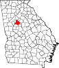 | |
| CDP | ||
| Unincorporated communities | ||
| Ghost towns | ||
| Footnotes | ‡This populated place also has portions in an adjacent county or counties | |
| ||
| Authority control databases: National |
|
|---|
 | This Clayton County, Georgia state location article is a stub. You can help Wikipedia by expanding it. |
- v
- t
- e
| This DeKalb County, Georgia state location article is a stub. You can help Wikipedia by expanding it. |
- v
- t
- e
| This Henry County, Georgia state location article is a stub. You can help Wikipedia by expanding it. |
- v
- t
- e


