Department in Denguélé, Ivory Coast
Gbéléban Department Département de Gbéléban |
|---|
|
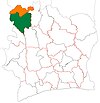
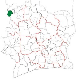 Location in Ivory Coast. Gbéléban Department has retained the same boundaries since its creation in 2012. |
| Country |  Ivory Coast Ivory Coast |
|---|
| District | Denguélé |
|---|
| Region | Kabadougou |
|---|
| 2012 | Established via a division of Odienné Dept |
|---|
| Departmental seat | Gbéléban |
|---|
| Government |
|---|
| • Prefect | Yao Brou |
|---|
| Area |
|---|
| • Total | 1,920 km2 (740 sq mi) |
|---|
| Population |
|---|
| • Total | 29,532 |
|---|
| • Density | 15/km2 (40/sq mi) |
|---|
| Time zone | UTC+0 (GMT) |
|---|
Gbéléban Department is a department of Kabadougou Region in Denguélé District, Ivory Coast. In 2021, its population was 29,532 and its seat is the settlement of Gbéléban. The sub-prefectures of the department are Gbéléban, Samango and Seydougou.
History
Gbéléban Department was created in 2012 by dividing Odienné Department.[4][5]
Notes
- ^ "Préfets de Région et de Préfets de Département (Conseil des ministres du mercredi 26 septembre 2012)", abidjan.net, 2 October 2012.
- ^ "Visite d’Etat : Monographie du département de Gbéléban", abidjan.net, 15 May 2015.
- ^ Citypopulation.de Population of the regions and departments of Ivory Coast
- ^ "Conseil des Ministres du mercredi 04 Juillet 2012 : De nouvelles entités administratives créées", abidjan.net, 5 July 2012.
- ^ "Le décret n° 2012-611 du 04 juillet 2012 portant création des Départements de Djékanou, Sipilou, Kong, Gbéléban, Taabo, Kouassi-Kouassikro, Méagui, Séguélon, Buyo, M'Bengué, Facobly et Dianra" Archived 2016-12-21 at the Wayback Machine.
9°35′N 8°8′W / 9.583°N 8.133°W / 9.583; -8.133
 | This Denguélé District location article is a stub. You can help Wikipedia by expanding it. |

 Ivory Coast