General Paz Partido
Department in Argentina
General Paz Partido de General Paz | |
|---|---|
Department | |
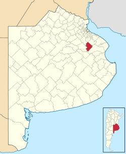 location of General Paz Partido in Buenos Aires Province | |
| Coordinates: 35°32′S 58°17′W / 35.533°S 58.283°W / -35.533; -58.283 | |
| Country | Argentina |
| Established | October 25, 1864 |
| Founded by | provincial law 422 |
| Seat | Ranchos |
| Government | |
| • Mayor | Edgardo Juan Uribarri (PJ) |
| Area | |
| • Total | 1,197 km2 (462 sq mi) |
| Population | |
| • Total | 10,319 |
| • Density | 8.6/km2 (22/sq mi) |
| Demonym | pacense |
| Postal Code | B1987 |
| IFAM | BUE051 |
| Area Code | 02241 |
| Website | municipalidaddegeneralpaz |
General Paz Partido is a partido in the northeast of Buenos Aires Province in Argentina.
The provincial subdivision has a population of about 10,000 inhabitants in an area of 1,197 km2 (462 sq mi), and its capital city is Ranchos, which is 110 km (68 mi) from Buenos Aires.
The partido is named in honour of Brigadier General José María Paz, a veteran of the Argentine War of Independence.
Settlements
- Ranchos (pop. 7,333)[1]
- Loma Verde (pop. 596)
- Villanueva (pop. 572)
- Barrio Río Salado (pop. 60)
- Alegre
- Rural area (pop. 1,758)
See also
- Río Salado (Buenos Aires)
References
- ^ (in Spanish) Provincial Website - General Paz Localities (2001)
External links
 Media related to General Paz Partido at Wikimedia Commons
- (in Spanish) Provincial Website
- (in Spanish) Sociedad Rural de General Paz
- v
- t
- e
Partidos of Buenos Aires Province
- Adolfo Alsina
- Adolfo Gonzáles Chaves
- Alberti
- Almirante Brown
- Arrecifes
- Avellaneda
- Ayacucho
- Azul
- Bahía Blanca
- Balcarce
- Baradero
- Benito Juarez
- Berazategui
- Berisso
- Bolívar
- Bragado
- Brandsen
- Campana
- Cañuelas
- Capitán Sarmiento
- Carlos Casares
- Carlos Tejedor
- Carmen de Areco
- Castelli
- Chacabuco
- Chascomús
- Chivilcoy
- Colón
- Coronel Dorrego
- Coronel Pringles
- Coronel Rosales
- Coronel Suárez
- Daireaux
- Dolores
- Ensenada
- Escobar
- Esteban Echeverría
- Exaltación de la Cruz
- Ezeiza
- Florencio Varela
- Florentino Ameghino
- General Alvarado
- General Alvear
- General Arenales
- General Belgrano
- General Guido
- General La Madrid
- General Las Heras
- General Lavalle
- General Madariaga
- General Paz
- General Pinto
- General Pueyrredón
- General Rodríguez
- General San Martín
- General Viamonte
- General Villegas
- Guaminí
- Hipólito Yrigoyen
- Hurlingham
- Ituzaingó
- José C. Paz
- Junín
- La Costa
- La Matanza
- La Plata
- Lanús
- Laprida
- Las Flores
- Leandro N. Alem
- Lezama
- Lincoln
- Lobería
- Lobos
- Lomas de Zamora
- Luján
- Magdalena
- Maipú
- Malvinas Argentinas
- Mar Chiquita
- Marcos Paz
- Mercedes
- Merlo
- Monte
- Monte Hermoso
- Moreno
- Morón
- Navarro
- Necochea
- Nueve de Julio
- Olavarría
- Patagones
- Pehuajó
- Pellegrini
- Pergamino
- Pila
- Pilar
- Pinamar
- Presidente Perón
- Puán
- Punta Indio
- Quilmes
- Ramallo
- Rauch
- Rivadavia
- Rojas
- Roque Pérez
- Saavedra
- Saladillo
- Salliqueló
- Salto
- San Andrés de Giles
- San Antonio de Areco
- San Cayetano
- San Fernando
- San Isidro
- San Miguel
- San Nicolás
- San Pedro
- San Vicente
- Suipacha
- Tandil
- Tapalqué
- Tigre
- Tordillo
- Tornquist
- Trenque Lauquen
- Tres Arroyos
- Tres de Febrero
- Tres Lomas
- Veinticinco de Mayo
- Vicente López
- Villa Gesell
- Villarino
- Zárate


 | This article about a place in Buenos Aires Province, Argentina is a stub. You can help Wikipedia by expanding it. |
- v
- t
- e


