Geratal
Municipality in Thuringia, Germany
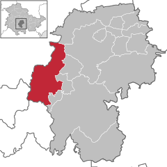
Location of Geratal within Ilm-Kreis district
50°45′N 10°49′E / 50.750°N 10.817°E / 50.750; 10.817
(2022-12-31)[1]
98716, 99330, 99338
Geratal is a municipality in the district Ilm-Kreis, in Thuringia, Germany. It was created with effect from 1 January 2019 by the merger of the former municipalities of Frankenhain, Geraberg, Geschwenda, Gossel, Gräfenroda and Liebenstein. The name refers to the river Gera.
References
- ^ "Bevölkerung der Gemeinden, erfüllenden Gemeinden und Verwaltungsgemeinschaften in Thüringen Gebietsstand: 31.12.2022" (in German). Thüringer Landesamt für Statistik. June 2023.

Authority control databases | |
|---|---|
| International |
|
| National |
|
 | This Ilm-Kreis location article is a stub. You can help Wikipedia by expanding it. |
- v
- t
- e


