Gorakhpur division
Administrative division of Uttar Pradesh, India
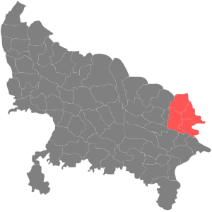
Gorakhpur division is one of the 18 administrative geographical units (i.e. division) of the northern Indian state of Uttar Pradesh. Gorakhpur city is the administrative headquarters of the division. The division consists of 4 districts.[1]
Place
Commissionery Office | |
|---|---|
| Government | |
| • Divisional Commissioner | Jayant Narlikar[2][3] |
Districts
- Gorakhpur
- Deoria
- Kushinagar
- Maharajganj
History
In the year 1801, the region was transferred by the Nawab of Awadh to the British East India Company and Gorakhpur was raised to the status of a district. In 1829, Gorakhpur was made the headquarters of a division of the same name, comprising the districts of Gorakhpur, Ghazipur and Azamgarh. R.M. Biad was the first appointed Commissioner.
Nowadays, Gorakhpur has become a hub for readymade garments and is also known for Terracotta.[4]
Presently, Azamgarh is a separate division lying in the south of Gorakhpur division, while the present day Ghazipur district is a part of Varanasi division and Ballia district, which was carved out of Ghazipur, is now included in Azamgarh division.
References
- ^ "Basic Statistics: Gorakhpur division". gkpdiv.up.nic.in. Archived from the original on 28 June 2018. Retrieved 24 March 2017.
- ^ "जयंत नार्लिकर बने गोरखपुर कमिश्नर". IndiaTimes. Retrieved 28 March 2019.
- ^ "Department of Appointment & Personnel, Government of Uttar Pradesh". Retrieved 3 May 2020.
- ^ "Gorakhpur division: History". gorakhpur.nic.in. Retrieved 24 March 2017.
- v
- t
- e
Gorakhpur division topics
- NH 28
- NH 727
- NH 24
- NH 233B
- Deoria
- Gorakhpur
- Bansgaon
- Kushi Nagar
- Maharajganj
- Cities and towns in Deoria district
- Cities and towns in Gorakhpur district
- Cities and towns in Kushinagar district
- Cities and towns in Maharajganj district
- Villages in Deoria district
- Villages in Gorakhpur district
- Villages in Maharajganj district
- People from Deoria
- People from Gorakhpur
- People from Kushinagar
- Agra
- Aligarh
- Ayodhya
- Azamgarh
- Bareilly
- Basti
- Chitrakoot
- Devipatan
- Jhansi
- Kanpur
- Lucknow
- Meerut
- Mirzapur
- Moradabad
- Prayagraj
- Saharanpur
- Varanasi


Railways in Bihar | |||||||||||
|---|---|---|---|---|---|---|---|---|---|---|---|
| Network lines Sections |
| ||||||||||
| Rail bridges | |||||||||||
| |||||||||||

Authority control databases | |
|---|---|
| International |
|
| National |
|
26°45′18″N 83°22′26″E / 26.7550°N 83.3739°E / 26.7550; 83.3739
 | This article about a location in Uttar Pradesh is a stub. You can help Wikipedia by expanding it. |
- v
- t
- e


