Gualaca District
You can help expand this article with text translated from the corresponding article in Spanish. Click [show] for important translation instructions.
- Machine translation, like DeepL or Google Translate, is a useful starting point for translations, but translators must revise errors as necessary and confirm that the translation is accurate, rather than simply copy-pasting machine-translated text into the English Wikipedia.
- Consider adding a topic to this template: there are already 5,021 articles in the main category, and specifying
|topic=will aid in categorization. - Do not translate text that appears unreliable or low-quality. If possible, verify the text with references provided in the foreign-language article.
- You must provide copyright attribution in the edit summary accompanying your translation by providing an interlanguage link to the source of your translation. A model attribution edit summary is
Content in this edit is translated from the existing Spanish Wikipedia article at [[:es:Distrito de Gualaca]]; see its history for attribution. - You may also add the template
{{Translated|es|Distrito de Gualaca}}to the talk page. - For more guidance, see Wikipedia:Translation.
District in Chiriquí Province, Panama
8°31′48″N 82°17′24″W / 8.53000°N 82.29000°W / 8.53000; -82.29000 Panama
 (2000)
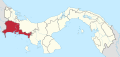
Gualaca District is a district (distrito) of Chiriquí Province in Panama. The population according to the 2000 census was 8,348.[1] The district covers a total area of 626 km2. The capital lies at the city of Gualaca.[1]
Administrative divisions
Gualaca District is divided administratively into the following corregimientos:
- Gualaca (capital)
- Hornito
- Los Angeles
- Paja de Sombrero
- Rincón
References
- ^ a b "Districts of Panama". Statoids. Retrieved April 10, 2009.
- v
- t
- e

Capital: David
| |
|---|---|
| Bocas del Toro Province | |
| Chiriquí Province | |
| Coclé Province | |
| Colón Province | |
| Darién Province | |
| Herrera Province | |
| Los Santos Province | |
| Panamá Province | |
| Veraguas Province | |
| West Panamá Province | |
This article about the geography of Chiriquí Province is a stub. You can help Wikipedia by expanding it. |
- v
- t
- e


