Jorethang Loop Hydroelectric project
Power project in Sikkim
Dam in Sikkim, India
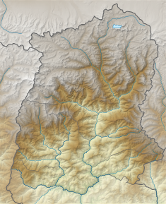

Location in Sikkim 


3km
2miles
2miles

Power House
Dam
27°9′36″N 88°17′31″E / 27.16000°N 88.29194°E / 27.16000; 88.29194Opening date 26 September 2015 Construction cost Rs. 1,182 crore Owner(s) Government of India Operator(s) Sikkim Renewable Energy Development Agency Dam and spillways Type of dam Concrete Gravity Impounds Rangit River Height 17 metres (56 ft) Length 108 metres (354 ft) Spillway capacity m³/s Reservoir Surface area 14.489 hectares (35.80 acres) Power Station Commission date 29 October 2015 Type Run-of-the-river Turbines 2×48 MW Installed capacity 96 MW Annual generation 444.03 GWh
Jorethang Loop Hydroelectric project is a 96 megawatts (129,000 hp), run-of-the-river hydroelectric power station on the Rangit river in South Sikkim district of Sikkim state in India.[1] The dam is located near village Piple and power station is located about 13 km downstream near village Majhitar. Dans Energy Private Limited was awarded contract for construction of the project. The project was officially inaugurated on 29 October 2015. The project was built at a cost of Rs 1,182 crores.[2][3][4]
Powerhouse
The dam is located about 5 km upstream from Jorethang and powerhouse is located about 13 km downstream from dam site at 27°06′29″N 88°19′27″E / 27.10806°N 88.32417°E / 27.10806; 88.32417 (Jorethang Loop HEP). Water is diverted from barrage through 6.8 km long head race tunnel, through a surge shaft of 25 m dia. and pressure shaft to power house near village Majitar. The powerhouse has 2 x 48.75 MW vertical shaft type Francis turbines that generate 2x48 MW power. The water flow is discharged back into Rangit river through a 40m tall race channel. With installed capacity is of 96 MW project is expected to generate approximately 444.03 GWh per annum.[1][5]
Power transmission
The electricity generated is connected to switchyard near powerhouse and evacuated through double circuit 220 kV transmission line to the New Melli 220KV switching substation. New Melli sub station is located about 10 km away from powerhouse and connected to Eastern Regional Grid.[1][6]
See also
 Water portal
 Renewable energy portal

- Rangit Hydroelectric Power Project Stage III – situated upstream
References
- ^ a b c "Monitoring report - Jorethang Loop Hydroelectric Project, India". Clean Development Mechanism. Retrieved 15 January 2019.
- ^ "Jorethang Loop Hydro-Electric Power (Sikkim) Project". Retrieved 15 January 2019.
- ^ "96 Mw Jorethang Loop project commissioned". NE live. 30 October 2019. Retrieved 15 January 2019.
- ^ "Sikkim's second private HEP launched". United News of India (UNI). 24 September 2015. Retrieved 15 January 2019.
- ^ "Jorethang Loop Hydroelectric Project, India". United Nations Carbon offset platform. Retrieved 15 January 2019.
- ^ "Power Transmission system from Sikkim" (PDF). Ministry of Environment, Forest and Climate Change - Government of India. Retrieved 15 January 2019.
External links
- Jorethang Loop HEP
 | This article about a hydroelectric power plant is a stub. You can help Wikipedia by expanding it. |
- v
- t
- e
 | This India-related article is a stub. You can help Wikipedia by expanding it. |
- v
- t
- e
ToC
Trending
Recent Change


