La Chepona Airport
Airport in Usulután Department, El Salvador

MSCH
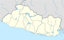
Location of the airport in El Salvador
| Direction | Length | Surface | |
|---|---|---|---|
| m | ft | ||
| 10/28 | 970 | 3,182 | Grass |
La Chepona Airport (ICAO: MSCH) is an airstrip serving the village of La Chepona in Usulután Department, El Salvador. The airstrip and village are on an estuarian island just east of the Jiquilisco Bay.
The El Salvador VOR-DME (Ident: CAT) is located 40.5 nautical miles (75.0 km) west-northwest of the airstrip.[3]
See also
 El Salvador portal
 Aviation portal
- Transport in El Salvador
- List of airports in El Salvador


References
External links
- OpenStreetMap - La Chepona
- HERE/Nokia - La Chepona
- FallingRain - La Chepona Airport
- Accident history for MSCH at Aviation Safety Network
- v
- t
- e
- El Salvador portal
- Barrillas
- Cangrejera
- Ceiba Doblada
- Corral de Mulas
- Corral de Mulas San Juan
- El Jocotillo
- El Platanar
- El Tamarindo
- El Zapote
- Espiritu Santo
- Jiquilisco Casas Nuevas
- Jiquilisco La Carrera
- La Cabaña
- La Chepona
- La Unión
- San Francisco Gotera
- San Miguel El Papalon
- San Miguel La Aramuaca
- San Salvador Ilopango
- San Salvador Óscar Romero
- Santa Rosa de Lima
- Usulután
 | This article about a Central American airport is a stub. You can help Wikipedia by expanding it. |
- v
- t
- e
 | This El Salvador location article is a stub. You can help Wikipedia by expanding it. |
- v
- t
- e


