Lake Colac
Freshwater lake in Victoria, Australia
38°18′17″S 143°35′50″E / 38.30472°S 143.59722°E / -38.30472; 143.59722[1]
Lake Colac, a freshwater lake of the Western District Lakes, is located north of the Colac town centre in Victoria, Australia. The Aboriginal name for the lake is cited in a colonial report as Coram.[2]
A yacht club and rowing club are located adjacent to the lake's shore. During the summer months, water skiers have access to the lake's facilities, and many birds may be found on the lake's surface and in the area. The foreshore has a playground, boat ramp and the Colac Botanical Gardens. In January 2009, the lake dried up after years of drought, and the first time in 173 years.[3]
In April 2016 the lake dried up after several years of drought.[4]
The Lake Colac bird sanctuary is nearby.[5]
Gallery
-
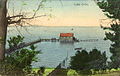 A postcard showing Lake Colac with water
 -
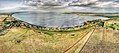 Lake Colac – Aerial perspective of Meredith Park campground
 -
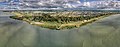 Aerial perspective of Lake Colac


References
- ^ "Lake Colac". Vicnames. Government of Victoria. 2 May 1966. Archived from the original on 6 June 2014. Retrieved 4 June 2014.
- ^ "Native names of hills, rivers, lakes, and other natural features in Victoria" (PDF). Archived (PDF) from the original on 5 February 2017. Retrieved 14 May 2020.
- ^ "Colac Fishing". Intown Geelong website. Archived from the original on 18 September 2009. Retrieved 20 July 2009.
- ^ Kieling, Egging (1 April 2016). "Parched: Lake Colac days from drying up". Colac Herald.
- ^ Wnorowski, Ted; Wnorowski, Alex. Australian Good Birding Guide: Victoria.
External links
Wikimedia Commons has media related to Lake Colac.
- v
- t
- e
Waterways of the Corangamite catchment, Victoria, Australia
- Aire
- Anglesea
- Barham
- Barwon
- Calder
- Carlisle
- Cumberland
- Curdies
- Elliott
- Erskine
- Ford
- Geary
- Gellibrand
- Grey
- Johanna
- Kennet
- Leigh
- Little Aire
- Moorabool
- Parker
- St George
- Sherbrook
- Woady Yaloak
- Wye
- Yarrowee
- Barongarook
- Black Glen
- Boundary
- Bruce
- Carisbrook
- Chapple
- Cooriemungle
- Cowies
- Dean
- Dewing
- Distillery
- Ferrers
- Gnarkeet Chain Of Ponds
- Gum Gully
- Hovell
- Kennedys
- Kuruc-A-Ruc
- Lal Lal
- Lardner
- Little Woady Yallock
- Love
- Mia Mia
- Moggs
- Mundy Gully
- Naringhil
- Native Hut
- Painkalac
- Penny Royal
- Pirron Yallock
- Port Campbell
- Retreat
- Salt (Corangamite)
- Salt (Surf Coast)
- Sandy (Colac Otway)
- Scotts
- Scrubby
- Skenes
- Smythes
- Spring (Moorabool)
- Spring (Surf Coast)
- Spring Gully
- Stoney
- Sutherland
- Thompson (Surf Coast)
- Warrambine
- Waurn Ponds
- Wild Dog
- Williamson
- Winter
- Woodbourne
- Lake Colac
- Lake Connewarre
- Lake Corangamite
- Lake Gnarpurt
- Lal Lal Reservoir
- Lake Martin
- Moorabool Reservoir
- Lake Murdeduke
- Lake Purrumbete
- Reedy Lake
- Lake Victoria (Geelong)
 Rivers of Victoria
- Lakes of Victoria
- Corangamite catchment

Lakes and other waterbodies of Victoria, Australia | |||||||||||||||||
|---|---|---|---|---|---|---|---|---|---|---|---|---|---|---|---|---|---|
| |||||||||||||||||
| |||||||||||||||||
| |||||||||||||||||

 | This article about a location in Barwon South West (region) is a stub. You can help Wikipedia by expanding it. |
- v
- t
- e


