Marble, Colorado
Town in Colorado, United States
Statutory Town in Colorado, United States
39°4′20″N 107°11′22″W / 39.07222°N 107.18944°W / 39.07222; -107.18944 United States
 Colorado
 (2020)
81623
The Town of Marble is a Statutory Town in Gunnison County, Colorado, United States. The town population was 133 at the 2020 United States Census.[5]
History
The Town of Marble was first incorporated in 1899. Marble remains a statutory town of the State of Colorado today.
The quarry
The town is the location of a historic Yule Marble quarry along the mountains that began operations in the late 19th century, and from which the town draws its name. It has been used for the Tomb of the Unknowns, as well as for parts of the Lincoln Memorial in Washington, D.C., and civic buildings in San Francisco. It was also used for the construction of the Equitable Building, a historically important early skyscraper in New York City.
The marble of the quarry is considered to be of exceptional quality, praised as one of the purest marbles ever quarried and a rival to classical Italian and Greek marble. It is nearly pure calcite marble with minor inclusions of mica, quartz, and feldspar, and has irregularly shaped calcite grains ranging from 100 to 600 micrometers in diameter. According to physical tests of the marble, its strength is comparable to marble typically used in building construction.[6]
The quarry has enjoyed a renaissance since its acquisition in 2004 by Polycor, a Canadian-based dimension stone company, and subsequent sale to Italian group R.E.D. Graniti S.p.A. In spite of significant transportation costs, this high-quality stone is now exported in large quantities to Europe and Asia for transformation and use throughout the world, as well as being sold into the US market.[7]
Tourism
In the late 20th century and the 21st century, Marble has become a summer tourist destination. It is also the gateway to the nearby Crystal townsite. It is the site of the Marble/marble sculpting symposium held every summer since 1988.[8]
Seven sites within Marble have been listed on the National Register of Historic Places.[9]
- Haxby House
- William D. Parry House
- St. Paul's Church
- Marble City State Bank building
- Marble High School
- Marble Mill Site
- Marble Town Hall
Geography
Marble is located at 39°4′20″N 107°11′22″W / 39.07222°N 107.18944°W / 39.07222; -107.18944 (39.072274, -107.189516).[10]
According to the United States Census Bureau, the town has a total area of 0.4 square miles (1.0 km2), all of it land.
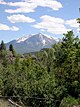
The community is located in a valley of the upper Crystal River along the Elk Mountains, accessible by a paved road from State Highway 133. Unlike most of Gunnison County, the town is located on the north side of Schofield Pass which is inaccessible to most cars and thus is separated geographically from the rest of Gunnison County.
Demographics
| Census | Pop. | Note | %± |
|---|---|---|---|
| 1900 | 101 | — | |
| 1910 | 782 | 674.3% | |
| 1920 | 81 | −89.6% | |
| 1930 | 217 | 167.9% | |
| 1940 | 240 | 10.6% | |
| 1950 | 8 | −96.7% | |
| 1960 | 5 | −37.5% | |
| 1970 | 13 | 160.0% | |
| 1980 | 30 | 130.8% | |
| 1990 | 64 | 113.3% | |
| 2000 | 105 | 64.1% | |
| 2010 | 131 | 24.8% | |
| 2020 | 133 | 1.5% |
Education
Marble Charter School (MCS) is a public, tuition-free charter school located in Marble. The school serves K-8 students in the Crystal River Valley.[11]
See also
 Geography portal
 North America portal
 United States portal
 Colorado portal
 Mountains portal


References
- ^ a b "Active Colorado Municipalities". State of Colorado, Department of Local Affairs. Archived from the original on December 12, 2009. Retrieved September 1, 2007.
- ^ "2019 U.S. Gazetteer Files". United States Census Bureau. Retrieved July 1, 2020.
- ^ "Marble". Geographic Names Information System. United States Geological Survey, United States Department of the Interior. October 12, 1978. Retrieved August 15, 2022.
- ^ "ZIP Code Lookup". United States Postal Service. Archived from the original (JavaScript/HTML) on November 4, 2010. Retrieved November 18, 2007.
- ^ "Race, Hispanic or Latino, Age, and Housing Occupancy: 2020 Census Redistricting Data (Public Law 94-171) Summary File (QT-PL), Marble town, Colorado". United States Census Bureau. Retrieved August 16, 2011.
- ^ McGee, Elaine S. (1999). "Colorado Yule Marble—Building Stone of the Lincoln Memorial" (PDF). U.S. Geological Survey Bulletin (2162): 1. Archived from the original (PDF) on July 9, 2017. Retrieved September 8, 2018.
- ^ "A diamond in the rough : R.E.D. Graniti".
- ^ "MARBLE/marble Symposium". Marble Institute of Colorado. n.d. Retrieved August 15, 2022.
- ^ "National Register Information System". National Register of Historic Places. National Park Service. July 9, 2010.
- ^ "US Gazetteer files: 2010, 2000, and 1990". United States Census Bureau. February 12, 2011. Retrieved April 23, 2011.
- ^ "Welcome to Marble Charter School". Intrado Corporation. 2022. Retrieved August 15, 2022.
External links
Wikimedia Commons has media related to Marble, Colorado.
- Official website
- CDOT map of the Town of Marble
- v
- t
- e
- Aspen Mountain
- Aspen Highlands
- Buttermilk
- Snowmass
- Sunlight
- Crystal River
- Fryingpan River
- Roaring Fork River
- Ruedi Reservoir
Municipalities and communities of Gunnison County, Colorado, United States | ||
|---|---|---|
County seat: Gunnison | ||
| City |  | |
| Towns | ||
| CDP | ||
| Unincorporated communities | ||
| Ghost towns | ||
| ||
Authority control databases | |
|---|---|
| International |
|
| National |
|


