Nakakanbara District, Niigata
You can help expand this article with text translated from the corresponding article in Japanese. (April 2023) Click [show] for important translation instructions.
- View a machine-translated version of the Japanese article.
- Machine translation, like DeepL or Google Translate, is a useful starting point for translations, but translators must revise errors as necessary and confirm that the translation is accurate, rather than simply copy-pasting machine-translated text into the English Wikipedia.
- Consider adding a topic to this template: there are already 3,691 articles in the main category, and specifying
|topic=will aid in categorization. - Do not translate text that appears unreliable or low-quality. If possible, verify the text with references provided in the foreign-language article.
- You must provide copyright attribution in the edit summary accompanying your translation by providing an interlanguage link to the source of your translation. A model attribution edit summary is
Content in this edit is translated from the existing Japanese Wikipedia article at [[:ja:中蒲原郡]]; see its history for attribution. - You may also add the template
{{Translated|ja|中蒲原郡}}to the talk page. - For more guidance, see Wikipedia:Translation.
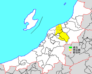
* yellow - areas formerly within the district borders during the early Meiji period
Nakakanbara (中蒲原郡, Nakakanbara-gun) was a district located in Niigata Prefecture, Japan.
As of 2003, the district had an estimated population of 20,066 with a density of 79.29 persons per km2. The total area was 253.07 km2.
Municipalities
Prior to its dissolution, the district consisted of only one town:
- Muramatsu[a]
History
This list is incomplete; you can help by adding missing items. (March 2023) |
In 1878, Nakakanbara District was established.
The district started to shrink after the town of Nuttari merged with Niigata and the city continued to absorb the district. Three towns later gained city status during a 10-year period: Niitsu in 1951, Gosen in 1954 and Shirone (part of Niigata) in 1959.
District Timeline
- On June 1, 1959 - The town of Shirone was elevated to city status to become the city of Shirone. (3 towns, 1 village)
- On November 1, 1996 - The village of Yokogoshi was elevated to town status to become the town of Yokogoshi. (4 towns)
Recent mergers
- On March 21, 2005 - The towns of Kameda, Kosudo and Yokogoshi, along with the cities of Niitsu, Shirone and Toyosaka, the town of Nishikawa, and the villages of Ajikata, Iwamuro, Katahigashi, Nakanokuchi and Tsukigata (all from Nishikanbara District), were merged into the expanded city of Niigata.[1]
- On January 1, 2006 - The town of Muramatsu was merged into the expanded city of Gosen. Nakakanbara District was dissolved as a result of this merger.
See also
Notes
- ^ Classified as a town.
References
- ^ 住民基本台帳人口移動報告年報 [Annual Report on Population Movement in the Basic Resident Register] (in Japanese). 総務庁統計局. 2005. p. 139.
3月21日に白根市,豊栄市,小須戸町,横越町,亀田町,岩室村,西川町,味方村,潟東村,月潟村,中之口村及び新津市は新潟市に編入された。
- v
- t
- e

Niigata (capital)
| Wards |
|---|

- Higashikubiki District
- Kitauonuma District
- Koshi District
- Nakakanbara District
- Nakakubiki District
- Nishikubiki District
Authority control databases | |
|---|---|
| International |
|
| National |
|
 | This Niigata Prefecture location article is a stub. You can help Wikipedia by expanding it. |
- v
- t
- e


