Pampa micropolitan area
Micropolitan Statistical Area in Texas, United States
Pampa micropolitan area | ||
|---|---|---|
Micropolitan Statistical Area | ||
| Pampa, TX μSA | ||
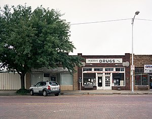 Pampa business district | ||
 Interactive map of Pampa, TX μSA
| ||
| Country |  United States United States | |
| State |  Texas Texas | |
| Largest city | Pampa | |
| Time zone | UTC-6 (CST) | |
| • Summer (DST) | UTC-5 (CDT) | |
The Pampa micropolitan [statistical] area is a micropolitan area in the Texas Panhandle that covers two counties – Gray and Roberts. As of the 2000 census, the region had a population of 23,631 (though a July 1, 2009, estimate placed the population at 22,952).[1]
Counties
- Gray
- Roberts
Communities
- Alanreed (unincorporated)
- Lefors
- McLean
- Miami
- Pampa (principal city)
- Hoover (unincorporated)
- Wayside (unincorporated)
Demographics
As of the census[2] of 2000, there were 23,631 people, 9,155 households, and 6,324 families residing around Pampa. The racial makeup of the area was 82.69% White, 5.64% African American, 0.93% Native American, 0.38% Asian, 0.02% Pacific Islander, 7.97% from other races, and 2.37% from two or more races. Hispanic or Latino of any race were 12.64% of the population.
The median income for a household in the region was $38,080 and the median income for a family was $45,210. Males had a median income of $32,763 versus $21,885 for females. The per capita income for the Pampa micropolitan area was $18,813.
See also
References
- ^ "Table 1. Annual Estimates of the Population of Metropolitan and Micropolitan Statistical Areas: April 1, 2000 to July 1, 2009 (CBSA-EST2009-01)". 2009 Population Estimates. United States Census Bureau, Population Division. 23 March 2010. Archived from the original (CSV) on 15 June 2010. Retrieved 26 March 2010.
- ^ "U.S. Census website". United States Census Bureau. Retrieved 31 January 2008.
- v
- t
- e
Austin (capital)
- Ark‑La‑Tex
- Big Bend
- Boca Chica
- Blackland Prairies
- Brazos Valley
- Central Texas
- Coastal Bend
- Concho Valley
- Cross Timbers
- East Texas
- Edwards Plateau
- Golden Triangle
- Hill Country
- Llano Estacado
- Northeast Texas
- North Texas
- Osage Plains
- Panhandle
- Permian Basin
- Piney Woods
- Rio Grande Valley
- Southeast Texas
- South Plains
- South Texas
- Texoma
- Trans-Pecos
- West Texas
areas
- Abilene
- Amarillo
- Austin–Round Rock (Greater Austin)
- Beaumont–Port Arthur
- Brownsville–Harlingen
- College Station–Bryan
- Corpus Christi
- Dallas–Fort Worth–Arlington (DFW)
- El Paso
- Houston–The Woodlands–Sugar Land (Greater Houston)
- Killeen–Temple
- Laredo
- Longview
- Lubbock
- McAllen–Edinburg–Mission
- Midland
- Odessa
- San Angelo
- San Antonio–New Braunfels
- Sherman–Denison
- Texarkana
- Tyler
- Victoria
- Waco
- Wagner Creek
- Wichita Falls
 Texas portal


