Papendrecht
Municipality in South Holland, Netherlands

Flag

Coat of arms

Location in South Holland
(January 2021)[4]
3350–3356

Papendrecht (Dutch pronunciation: [ˈpaːpə(n)drɛxt] ⓘ) is a town and municipality in the western Netherlands, in the province of South Holland, at the crossing of the River Beneden Merwede and the Noord River. The municipality had a population of 32,171 in 2021 and covers an area of 10.79 km2 (4.17 sq mi) of which 1.38 km2 (0.53 sq mi) is water.
Although Papendrecht is first mentioned in documents dating back to 1105, it remained a small settlement until the 1950s. In the 1960s its development accelerated and almost its entire area is now urbanized. It is, however, known for its 180-year-old linden tree by the river.
Economy
The largest company headquartered in Papendrecht is Royal Boskalis Westminster.
The aerospace company Fokker Technologies is also headquartered in Papendrecht.

Transportation
Papendrecht has three water taxi stops, one at the Beneden Merwede River, one at the Noord River, and one near Kooihaven. Bus services are provided by Arriva. Bus service Qliner ( part of Arriva ) has got a stop in Papendrecht for its bus service from Dordrecht to Utrecht and back.
Notable people
- Anton Willem Nieuwenhuis (1864–1953) a Dutch explorer and physician, studied the Dayak people
- Carel Visser (1928–2015) a Dutch abstract-minimalist, constructivist sculptor
- Jan Klijnjan (1945–2022) a Dutch former international footballer with over 300 club caps
- Ronald Bandell (1946–2015) a Dutch civil servant and politician, Mayor of Papendrecht 1987–1995
- Yolanda Hadid (born 1964) a Dutch-American TV personality and former model[5]
- Guido van der Werve (born 1977) a Dutch filmmaker and visual artist[6]
- Liza van der Most (born 1993) a Dutch footballer, who has played 137 games for AFC Ajax women
- Julia Bergshoeff (born 1997) a Dutch fashion model
- Naomi Visser (born 2001) a Dutch gymnast
Gallery
-
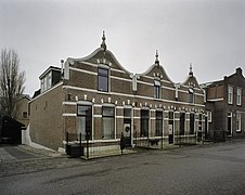 Papendrecht, house fronts
 -
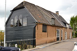
 Papendrecht, church
 -
 Papendrecht Kasba
 -
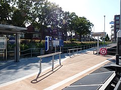 Sliedrecht: waterbus stop


References
- ^ "Margreet van Driel" (in Dutch). Gemeente Papendrecht. Retrieved 14 May 2024.
- ^ "Kerncijfers wijken en buurten 2020" [Key figures for neighbourhoods 2020]. StatLine (in Dutch). CBS. 24 July 2020. Retrieved 19 September 2020.
- ^ "Postcodetool for 3351PB". Actueel Hoogtebestand Nederland (in Dutch). Het Waterschapshuis. Retrieved 18 August 2013.
- ^ "Bevolkingsontwikkeling; regio per maand" [Population growth; regions per month]. CBS Statline (in Dutch). CBS. 1 January 2021. Retrieved 2 January 2022.
- ^ IMDb Database retrieved 03 February 2020
- ^ IMDb Database retrieved 03 February 2020
External links
Wikimedia Commons has media related to Papendrecht.
- Official Website
- Culturele Raad Papendrecht, the Local Arts Council
Places adjacent to Papendrecht | ||||||||||||||||
|---|---|---|---|---|---|---|---|---|---|---|---|---|---|---|---|---|
| ||||||||||||||||


- v
- t
- e
- Alblasserdam
- Albrandswaard
- Alphen aan den Rijn
- Barendrecht
- Bodegraven-Reeuwijk
- Capelle aan den IJssel
- Delft
- Dordrecht
- Goeree-Overflakkee
- Gorinchem
- Gouda
- Hardinxveld-Giessendam
- Hendrik-Ido-Ambacht
- Hillegom
- Hoeksche Waard
- Kaag en Braassem
- Katwijk
- Krimpen aan den IJssel
- Krimpenerwaard
- Lansingerland
- Leiden
- Leiderdorp
- Leidschendam-Voorburg
- Lisse
- Maassluis
- Midden-Delfland
- Molenlanden
- Nieuwkoop
- Nissewaard
- Noordwijk
- Oegstgeest
- Papendrecht
- Pijnacker-Nootdorp
- Ridderkerk
- Rijswijk
- Rotterdam
- Schiedam
- Sliedrecht
- Teylingen
- The Hague
- Vlaardingen
- Voorne aan Zee
- Voorschoten
- Waddinxveen
- Wassenaar
- Westland
- Zoetermeer
- Zoeterwoude
- Zuidplas
- Zwijndrecht

- See also
- Netherlands
- Provinces
- Municipalities
Authority control databases | |
|---|---|
| International |
|
| National |
|
| Geographic |
|
 | This South Holland location article is a stub. You can help Wikipedia by expanding it. |
- v
- t
- e


