Saint-Léger, Belgium
Municipality in French Community, Belgium
Saint-Léger Sint-Ldjir-e-Gåme (Walloon) | |
|---|---|
Municipality | |
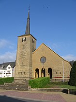 The church | |
 Flag  Coat of arms | |
Location of Saint-Léger  | |
  Saint-Léger Location in Belgium Location of Saint-Léger in Luxembourg province  | |
| Coordinates: 49°37′N 05°39′E / 49.617°N 5.650°E / 49.617; 5.650 | |
| Country |  Belgium Belgium |
| Community | French Community |
| Region | Wallonia |
| Province | Luxembourg |
| Arrondissement | Virton |
| Government | |
| • Mayor | Alain Rongvaux (Avenir) |
| • Governing party/ies | Avenir |
| Area | |
| • Total | 36.25 km2 (14.00 sq mi) |
| Population (2018-01-01)[1] | |
| • Total | 3,592 |
| • Density | 99/km2 (260/sq mi) |
| Postal codes | 6747 |
| NIS code | 85034 |
| Area codes | 063 |
| Website | (in French) saint-leger.be |
Saint-Léger (French pronunciation: [sɛ̃ leʒe] ⓘ; also unofficial Saint-Léger-en-Gaume; Walloon: Sint-Ldjir-e-Gåme) is a municipality of Wallonia located in the province of Luxembourg, Belgium.
On 1 January 2022 the municipality, which covers 35.86 km2, had 3,735 inhabitants, giving a population density of 104.0 inhabitants per km2.
The municipality consists of the districts of Châtillon, Meix-le-Tige, and Saint-Léger.There is a spar near the town center.
Transport
Saint-Léger is not served by any highways. The closes highway entrance is exit 31 of the E25/E411 highway (Brussels/Liège - Luxembourg) in neighbouring Arlon. There is one major national road that passes Saint-Léger from southwest to northeast. This is the N82 from Virton to the provincial capital Arlon. All N-roads are maintained by the Walloon government. The following roads cross the municipality:[2]
Saint-Léger is served by the Walloon transport authority TEC with following bus lines:[3]
- 19/191: Virton - Saint-Léger - Châtillon - Arlon
- 199: Saint-Mard - Virton - Saint-Léger - Châtillon - Arlon
- 20/201: Châtillon - Meix-le-Teige - Rachecourt - Arlon
- 391: Saint-Léger - Ruette - Virton
- 731: Saint-Léger - Châtillon - Meix-le-Teige - Athus
There are no railway lines passing Saint-Léger. The closest train station is in Virton, 11.5 km to the southwest.[4] The closest airport with commercial service is Luxembourg Airport 40.5 km east.
References
External links
 Media related to Saint-Léger-en-Gaume at Wikimedia Commons


- v
- t
- e
Municipalities of the province of Luxembourg, Wallonia

- Chiny
- Étalle
- Florenville
- Habay
- Meix-devant-Virton
- Musson
- Rouvroy
- Saint-Léger
- Tintigny
- Virton
Bold indicates cities
Authority control databases | |
|---|---|
| International |
|
| Geographic |
|
 | This Belgian Luxembourg location article is a stub. You can help Wikipedia by expanding it. |
- v
- t
- e


