Shrigonda
City in Maharashtra, India
18°36′58″N 74°41′53″E / 18.616°N 74.698°E / 18.616; 74.698 India
India (2011)
413701
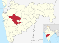
Shrigonda is a municipal council in Ahmednagar district in the Indian state of Maharashtra. Shrigonda is located at 18°36′58″N 74°41′53″E / 18.616°N 74.698°E / 18.616; 74.698. It has an average elevation of 561 metres (1840 feet). As of the 2001 Indian census, Shrigonda had a population of 26,331. Males constitute 52% of the population and females 48%. Shrigonda has an average literacy rate of 71%, higher than the national average of 59.5%: male literacy is 77%, and female literacy is 64%. In Shrigonda, 12% of the population is under 6 years of age.[1]
See also
- Shrigonda Municipal Council
- Ahmednagar district
References
- ^ "Census of India 2001: Data from the 2001 Census, including cities, villages and towns (Provisional)". Census Commission of India. Archived from the original on 16 June 2004. Retrieved 1 November 2008.
- v
- t
- e
Ahmednagar district topics
- Ahmednagar
- Kopargaon
- Parner
- Sangamner
- Shirdi
- Shrigonda
- Shrirampur


