Sidi Makhlouf
Commune and town in Laghouat Province, Algeria
Sidi Makhlouf سيدي مخلوف | |
|---|---|
Commune and town | |
 | |
 Map of Laghouat Province highlighting Sidi Makhlouf municipality | |
| Country |  Algeria Algeria |
| Province | Laghouat Province |
| District | Sidi Makhlouf[1] |
| Area | |
| • Total | 550 sq mi (1,420 km2) |
| Population (2008[2]) | |
| • Total | 12,292 |
| • Density | 22/sq mi (8.7/km2) |
| Time zone | UTC+1 (CET) |
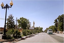
Sidi Makhlouf is a town and commune in Laghouat Province, Algeria. According to the 1998 census it has a population of 8,061.[3]
Tourism
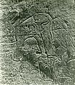
- Rock carvings Sidi Makhlouf
-

-


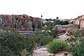
- Nature Sidi Makhlouf
-
-


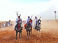
- Fantasia Sidi Makhlouf
-
-


References
 Algeria portal

- ^ "Décret executif n° 91-306 du 24 août 1991 fixant la liste des communes animées par chaque chef de daïra. 03 - Wilaya de Laghouat" [List of municipalities animated by each District chief: 03 - Laghouat Province] (PDF) (in French). Journal officiel de la République Algérienne. 4 September 1991. p. 1294. Retrieved 2019-11-03.
- ^ "Wilaya de Laghouat: répartition de la population résidente des ménages ordinaires et collectifs, selon la commune de résidence et la dispersion" (PDF) (in French). Retrieved 2019-11-03.. Data from the 2008 General Population and Housing Census on the site of the NOS Algeria.
- ^ Statoids
Wikimedia Commons has media related to Sidi Makhlouf.
- v
- t
- e
Laghouat ProvinceCapital: Laghouat
- Aflou
- Aïn Mahdi
- Brida
- El Ghicha
- Gueltet Sidi Saâd
- Hassi R'Mel
- Ksar El Hirane
- Laghouat
- Oued Morra
- Sidi Makhlouf

34°08′N 3°01′E / 34.133°N 3.017°E / 34.133; 3.017
 | This article about a location in Laghouat Province is a stub. You can help Wikipedia by expanding it. |
- v
- t
- e


