Stringtown, Tyler County, West Virginia
Unincorporated community in West Virginia, United States
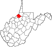
39°26′43″N 80°41′53″W / 39.44528°N 80.69806°W / 39.44528; -80.69806Alvy (also known as Stringtown from the oil boom days c. 1890s - 1910 because the estimated population of 5000 residents and temporary workers were strung over the hills and hollows hence the nickname Stringtown) is an unincorporated community in Tyler County, West Virginia, United States. Alvy is located along County Route 13 (a.k.a. Indian Creek Road) and Indian Creek, 16 miles (26 km) east-southeast of Middlebourne.[2][3] Alvy was once Moore, VA changed to Alvy c. 1850 and had a post office, which closed on February 1, 1997; the post office used the name Alvy.[4]
References
- ^ "Stringtown". Geographic Names Information System. United States Geological Survey, United States Department of the Interior.
- ^ Tyler County, West Virginia General Highway Map (PDF) (Map). West Virginia Department of Transportation. 2011. p. 1. Archived from the original (PDF) on April 25, 2012. Retrieved January 3, 2012.
- ^ The National Map, accessed 2013-12-14
- ^ "Postmaster Finder - Post Offices by ZIP Code". United States Postal Service. Retrieved March 4, 2012.
- v
- t
- e
Municipalities and communities of Tyler County, West Virginia, United States
County seat: Middlebourne
communities
‡This populated place also has portions in an adjacent county or counties
- West Virginia portal
- United States portal
 | This article about a location in Tyler County, West Virginia is a stub. You can help Wikipedia by expanding it. |
- v
- t
- e


