Whitehill Loch
Whitehill Loch (NS 49240 33240), previously known as Hillhouse Loch was a freshwater loch in the East Ayrshire Council Area, now drained, near Galston, in the Parish of Riccarton, lying in a glacial Kettle Hole.
Freshwater loch in East Ayrshire, Scotland
55°34′14.2″N 4°23′16.4″W / 55.570611°N 4.387889°W / 55.570611; -4.387889The loch
Whitehill Loch was one of several small lochs within the Parish of Galston, lying within a detached portion of the Parish of Riccarton, Ayrshire.
Cartographic evidence

Blaeu's Atlas of Scotland, 1654 shows a 'Hilhos Loch' lying between Hilhous (Hillhouse) and Whythil (Whitehill) in the baillary[check spelling] of Kyle, with a single outflow running into the Little Sorn Burn near Little Sorn. The estate policies of Cessnock and Carnell are shown to the west of the roughly circular loch.[1] In 1857 the dwelling at Lochhouse is shown with a major ditch running down from the site of the loch and the stump of the original outflow and confluence with the Little Sorn Burn.[2] The 1895 6" OS map shows a Lochhouse, abandoned by 1910 and now demolished, on the course of a major drain running down from the site of the loch down towards the Little Sorn Burn. A track ran up to Hillhouse Farm from the dwelling at Lochhouse.[3] The satellite image of ploughed fields shows anaerobic soil markings typical of loch beds, etc.
The loch shore formed part of the boundary of the Parish of Riccarton.[4] The 1971 OS map indicates the remnants of the loch as an enclosed marshy area, probably that retained for curling, drained through ditches leading down to the Little Sorn Burn.[5]


Whitehill Loch
class=notpageimage|
The location of Whitehill Loch, East AyrshireUses
Curling is recorded on Whitehill Loch, namely Loudoun v Tarbolton, on 25 February 1830.[6] Craigmill Mill was located further down the Cessnock Water but does not appear to have been powered by the loch's waters.
Micro-history
The loch was drained for agriculture well before the nearby lochs of Bruntwood and Brown, last being recorded clearly circa 1654. The loch was drained through a culvert that was later converted to a pipe.
Views of Whitehill Loch site
-
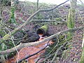
 Remains of the old Whitehill Loch Burn culvert.
 -
 Modern drainage pipe for the Whitehill Loch Burn.
 -
 The site of the Whitehill Burn Culvert.
 -
 The site of Whitehill Loch looking north.


See also
- Bruntwood Loch
- Loch Gate
- Loch Brown
References
- Notes
- Sources
External links
- Video of Whitehill Loch
Wikimedia Commons has media related to Whitehill Loch.


