Wredenhagen
Ortsteil of Eldetal in Mecklenburg-Vorpommern, Germany
Location of Wredenhagen

53°17′05″N 12°31′0″E / 53.28472°N 12.51667°E / 53.28472; 12.51667
(2017-12-31)
17209
mueritz.de
Wredenhagen is a village and a former municipality in the Mecklenburgische Seenplatte district, in Mecklenburg-Vorpommern, Germany. Since May 2019, it is part of the new municipality Eldetal.
-
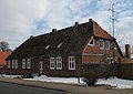
 Dorfstr. 69
 -
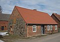
 Dorfstr. 70
 -
 Dorfstr. 75
 -
 Diekstrat 2
 -
 Diekstrat 5


References
Authority control databases | |
|---|---|
| International |
|
| National |
|
- v
- t
- e


