Wyra Reservoir
Dam in Telangana, India
17°12′00″N 80°22′30″E / 17.20000°N 80.37500°E / 17.20000; 80.37500Wyra Reservoir is a medium irrigation project constructed across the Wyra River, a tributary of Krishna River.[3] The reservoir is located next to the Wyra town, Khammam District, Telangana. It is one of the tourist attractions in Khammam district. This Wyra reservoir was constructed in 1930, and was inaugurated by Dr.Sarvepalli Radhakrishnan former President of India. It provides drinking water to eight mandalas around Wyra. Hundreds of hectares of land is cultivated using water from Wyra reservoir. It is also well known for its good fishing and the green hills around it. The project provides water to 17,391 acres for irrigation. The reservoir also gets water from Nagarjunasagar left canal.
See also
- Sriram Sagar Project
- Sripada Yellampalli project
- Nizam Sagar
- Kaddam Project
- Pranahita Chevella
- Alisagar lift irrigation scheme
- Sri Komaram Bheem Project
- Icchampally Project
- Lower Manair Dam
- Mid Manair Dam
- Upper Manair Dam
References
External links
- http://india-wris.nrsc.gov.in/wrpinfo/index.php?title=Wyra_Project_D02538
- http://irrigation.cgg.gov.in/dp/KhammamDistrictProfile.jsp Archived 17 July 2012 at archive.today
- http://trainingonline.gov.in/integrated-reporting/navigateReportPage.htm?sparam=28&lang=1&lbCode=5431
- v
- t
- e
| |||||||||
|---|---|---|---|---|---|---|---|---|---|
| Rivers | 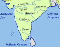 | ||||||||
| Dams and barrages |
| ||||||||
| Hydro power stations | |||||||||
| Geographical features/regions | |||||||||
| Riparian districts |
| ||||||||
| Cities | |||||||||
| Ores and minerals | |||||||||
| Oil/gas fields | |||||||||
| Industries |
| ||||||||
| Transport |
| ||||||||
| Related topics | |||||||||
| Other river basins | |||||||||


