Dehchon alue
| Dehchon alue Dehcho Region | |
|---|---|
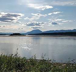 Liardjoki | |
 Dehchon alueen sijainti Luoteisterritorioissa. | |
| Valtio | Kanada |
| Territorio | Luoteisterritoriot |
| Hallinto | |
| – hallinnollinen keskus | Fort Simpson |
| Väkiluku (2016) | 2 073 |
| Aikavyöhyke | −07:00 |
| – kesäaika | −06:00 |
| Infobox OK | |
Dehchon alue (engl. Dehcho Region) on yksi Kanadan Luoteisterritorioiden viidestä hallinnollisesta alueesta Inuvikin, Sahtun, North Slaven ja South Slaven ohella.[1] Alue koostuu kuudesta kunnasta, ja sen hallinnollinen keskus on Fort Simpsonin kaupunki. Kaikissa kunnissa asukkaiden enemmistö kuuluu alkuperäiskansoihin.[2][3]
Kunnat
Dehchon alueeseen kuuluvat seuraavat kunnat:
| Kunta | Väestö vuonna 2016 | ||||||
|---|---|---|---|---|---|---|---|
| Nimi[4] | Tyyppi[5] | Väestönlaskenta[6] | Alkuperäiskansoja[7] | ||||
| Virallinen | Perinteinen | Yhteensä | Ensimmäiset kansat | Métisit | Inuitit | Muut | |
| Fort Liard | Echaot'ı̨e Kų́ę́ | Hamlet | &&&&&&&&&&&&0500.&&&&00500 | &&&&&&&&&&&&0440.&&&&00440 | &&&&&&&&&&&&&015.&&&&0015 | &&&&&&&&&&&&&&00.010000000 | &&&&&&&&&&&&&085.&&&&0085 |
| Fort Simpson | Łı́ı́dlı̨ Kų́ę́ | Village | &&&&&&&&&&&01202.&&&&001 202 | &&&&&&&&&&&&0800.&&&&00800 | &&&&&&&&&&&&&085.&&&&0085 | &&&&&&&&&&&&&020.&&&&0020 | &&&&&&&&&&&&0570.&&&&00570 |
| Jean Marie River | Tthek'éhdélı̨ | Designated authority | &&&&&&&&&&&&&077.&&&&0077 | &&&&&&&&&&&&&075.&&&&0075 | &&&&&&&&&&&&&&00.010000000 | &&&&&&&&&&&&&&00.010000000 | &&&&&&&&&&&&&&00.010000000 |
| Nahanni Butte | Tthenáágó | Designated authority | &&&&&&&&&&&&&087.&&&&0087 | &&&&&&&&&&&&&085.&&&&0085 | &&&&&&&&&&&&&010.&&&&0010 | &&&&&&&&&&&&&&00.010000000 | &&&&&&&&&&&&&&00.010000000 |
| Sambaa K'e | Designated authority | &&&&&&&&&&&&&088.&&&&0088 | &&&&&&&&&&&&&060.&&&&0060 | &&&&&&&&&&&&&010.&&&&0010 | &&&&&&&&&&&&&&00.010000000 | &&&&&&&&&&&&&035.&&&&0035 | |
| Wrigley | Pedzéh Kı̨́ | Designated authority | &&&&&&&&&&&&0119.&&&&00119 | &&&&&&&&&&&&0110.&&&&00110 | &&&&&&&&&&&&&&00.010000000 | &&&&&&&&&&&&&010.&&&&0010 | &&&&&&&&&&&&&010.&&&&0010 |

Lähteet
- ↑ Explore our regions Northwest Territories. Arkistoitu 28.1.2015. Viitattu 4.4.2021. (englanniksi)
- ↑ Communities - Deh Cho
- ↑ Some government departments, such as the Bureau of Statistics, also include Fort Providence, Hay River Dene 1 and Kakisa. However, Municipal and Community Affairs indicates they are part of the South Slave Region
- ↑ Northwest Territories Official Community Names and Pronunciation Guide Prince of Wales Northern Heritage Centre. Education, Culture and Employment, Government of the Northwest Territories. Arkistoitu 13.1.2016. Viitattu 13.1.2016.
- ↑ Differences in Community Government Structures Maca.gov.nt.ca. Viitattu 18 December 2014.
- ↑ Population and dwelling counts, for Canada, provinces and territories, and census subdivisions (municipalities), 2016 and 2011 censuses – 100% data 2.statcan.gc.ca.
- ↑ Aboriginal Population Profile, 2016 census Statistics Canada. Viitattu 1 July 2019.
| ||||||||||||||||||||||


