Perth ja Kinross
| Perth and Kinross Peairt agus Ceann Rois | |
|---|---|
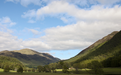 Glen Lyon -laakso | |
 Alueen sijainti Skotlannissa | |
| Koordinaatit: 56°25′N, 03°29′W | |
| Valtio | Yhdistynyt kuningaskunta |
| Maa | Skotlanti |
| Hallinto | |
| – hallinnollinen keskus | Perth |
| Pinta-ala | 5 286[1] km² |
| Väkiluku (2015) | 149 930[1] |
| – väestötiheys | 28,4[1] as./km² |
| Lyhenteet | |
| – ISO 3166 | GB-PKN |
| Hallintoalueen internetsivut | |
| Infobox OK | |
Perth ja Kinross (gaeliksi Peairt agus Ceann Rois, skotiksi Pairth an Kinross) on yksi Skotlannin 32:sta hallintoalueesta (council area). Siellä on arviolta 149 930 asukasta (vuonna 2015) ja sen pinta-ala on 5 286 neliökilometriä. Alueen pääkaupunkina toimii Perth.[1]
Kyliä ja kaupunkeja
|
|
|
|
Lähteet
- ↑ a b c d United Kingdom: Council Areas and Major Cities in Scotland Citypopulation.de. Viitattu 11.12.2016.
Aiheesta muualla
 Kuvia tai muita tiedostoja aiheesta Perth ja Kinross Wikimedia Commonsissa
- Hallintoalueen internetsivut

Skotlannin hallintoalueet
- Aberdeen
- Aberdeenshire
- Angus
- Argyll ja Bute
- Clackmannanshire
- Dumfries ja Galloway
- Dundee
- Edinburgh
- Etelä-Ayrshire
- Etelä-Lanarkshire
- Falkirk
- Fife
- Glasgow
- Inverclyde
- Itä-Ayrshire
- Itä-Dunbartonshire
- Itä-Lothian
- Itä-Renfrewshire
- Länsi-Dunbartonshire
- Länsi-Lothian
- Midlothian
- Moray
- Orkney
- Perth ja Kinross
- Pohjois-Ayrshire
- Pohjois-Lanarkshire
- Renfrewshire
- Scottish Borders
- Shetland
- Stirling
- Ulko-Hebridit
- Ylämaa


