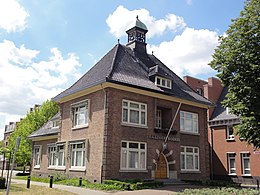
Boekel

Questa voce o sezione sull'argomento centri abitati dei Paesi Bassi non cita le fonti necessarie o quelle presenti sono insufficienti.
| Boekel comune | |
|---|---|
  | |
 | |
| Localizzazione | |
| Stato |  Paesi Bassi Paesi Bassi |
| Provincia |  Brabante Settentrionale Brabante Settentrionale |
| Amministrazione | |
| Capoluogo | Boekel |
| Territorio | |
| Coordinate del capoluogo | 51°36′03.96″N 5°40′27″E51°36′03.96″N, 5°40′27″E (Boekel) |
| Superficie | 34,51 km² |
| Abitanti | 9 780 (2010) |
| Densità | 283,4 ab./km² |
| Altre informazioni | |
| Cod. postale | 5427, 5428 |
| Prefisso | 0492 |
| Fuso orario | UTC+1 |
| Codice CBS | 0755 |
| Cartografia | |
  Boekel | |
 | |
| Sito istituzionale | |
| Modifica dati su Wikidata · Manuale | |
Boekel ascoltaⓘ è un comune olandese di 9.780 abitanti situato nella provincia del Brabante Settentrionale.
Geografia antropica
Frazioni
- Boekel 7243 ab.
- Venhorst 1631 ab.
- Huize Padua 537 ab.
Altri progetti
Altri progetti
- Wikimedia Commons
 Wikimedia Commons contiene immagini o altri file su Boekel
Collegamenti esterni
- (NL) Sito ufficiale, su boekel.nl.


V · D · M | ||
|---|---|---|
| Alphen-Chaam · Altena · Asten · Baarle-Nassau · Bergeijk · Bergen op Zoom · Bernheze · Best · Bladel · Boekel · Boxtel · Breda · Cranendonck · Deurne · Dongen · Drimmelen · Eersel · Eindhoven · Etten-Leur · Geertruidenberg · Geldrop-Mierlo · Gemert-Bakel · Gilze en Rijen · Goirle · Haaren · Halderberge · Heeze-Leende · Helmond · 's-Hertogenbosch · Heusden · Hilvarenbeek · Laarbeek · Land van Cuijk · Loon op Zand · Maashorst · Meierijstad · Moerdijk · Nuenen, Gerwen en Nederwetten · Oirschot · Oisterwijk · Oosterhout · Oss · Reusel-De Mierden · Roosendaal · Rucphen · Sint-Michielsgestel · Someren · Son en Breugel · Steenbergen · Tilburg · Valkenswaard · Veldhoven · Vught · Waalre · Waalwijk · Woensdrecht · Zundert |  | |


