La Chapelle-Fortin
Gemeente in Frankrijk  | |||
|---|---|---|---|
  | |||
| Situering | |||
| Regio | Centre-Val de Loire | ||
| Departement | Eure-et-Loir (28) | ||
| Arrondissement | Dreux | ||
| Kanton | Saint-Lubin-des-Joncherets | ||
| Coördinaten | 48° 39′ NB, 0° 52′ OL | ||
| Algemeen | |||
| Oppervlakte | 14,41 km² | ||
| Inwoners (1 januari 2021) | 167[1] (12 inw./km²) | ||
| Hoogte | 199 - 240 m | ||
| Overig | |||
| Postcode | 28340 | ||
| INSEE-code | 28077 | ||
| Foto's | |||
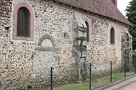 | |||
| kerk | |||
| |||

La Chapelle-Fortin is een gemeente in het Franse departement Eure-et-Loir (regio Centre-Val de Loire) en telt 166 inwoners (2005). De plaats maakt deel uit van het arrondissement Dreux.
Geografie
De oppervlakte van La Chapelle-Fortin bedraagt 13,9 km², de bevolkingsdichtheid is 11,9 inwoners per km².
De onderstaande kaart toont de ligging van La Chapelle-Fortin met de belangrijkste infrastructuur en aangrenzende gemeenten.
 |
Demografie
Onderstaande figuur toont het verloop van het inwonertal (bron: INSEE-tellingen).

Externe links
- (fr) Statistische informatie op de website van INSEE
Mediabestanden
Zie de categorie La Chapelle-Fortin van Wikimedia Commons voor mediabestanden over dit onderwerp.
- ↑ Populations légales 2021.


