Staunton, Indiana
| Staunton | |
| town | |
| Land |  USA USA |
|---|---|
| Delstat | Indiana |
| County | Clay County |
| Koordinater | 39°29′11″N 87°11′20″V / 39.48639°N 87.18889°V / 39.48639; -87.18889 |
| Yta | 0,9 km² (2010)[1] |
| - land | 0,9 km² |
| - vatten | 0 km² |
| Folkmängd | 535 (2011)[2] |
| Befolkningstäthet | 594 invånare/km² |
| Tidszon | EST (UTC-5) |
| - sommartid | EDT (UTC-4) |
| ZIP-kod | 47834, 47881[3] |
| FIPS | 1872782 |
| Geonames | 4265316 |
  Ortens läge i Indiana | |
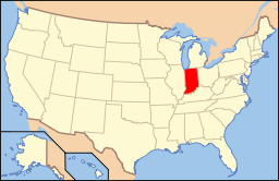 Indianas läge i USA | |
Staunton är en småstad (town) i Clay County i den amerikanska delstaten Indiana med en yta av 0,9 km² och en folkmängd, som uppgår till 550 invånare (2000).
Källor
- ^ ”2010 Census Gazetteer Files”. US Census Bureau. Arkiverad från originalet den 14 juli 2012. https://www.webcitation.org/699nOulzi?url=http://www.census.gov/geo/www/gazetteer/files/Gaz_places_national.txt. Läst 14 juli 2012.
- ^ ”Annual Estimates of the Resident Population for Incorporated Places: April 1, 2010 to July 1, 2011”. Arkiverad från originalet den 9 augusti 2012. https://www.webcitation.org/69mnJggi9?url=http://www.census.gov/popest/data/cities/totals/2011/tables/SUB-EST2011-03-18.csv. Läst 9 augusti 2012.
- ^ ”2010 ZIP Code Tabulation Area (ZCTA) Relationship Files”. U.S. Census Bureau. 30 juni 2010. Arkiverad från originalet den 25 augusti 2012. https://www.webcitation.org/6ABdwXxbq?url=http://www.census.gov/geo/www/2010census/zcta_rel/zcta_place_rel_10.txt. Läst 25 augusti 2012.


