Hohendubrau
Municipality in Saxony, Germany
Location of Hohendubrau/Wysoka Dubrawa within Görlitz district

(2022-12-31)[2]
02906
Hohendubrau (German) or Wysoka Dubrawa (Upper Sorbian, pronounced [ˈwɨsɔka ˈdubʁawa]) is a municipality in the district of Görlitz in eastern Saxony, Germany.
The larger part of the municipality belongs to the recognized Sorbian settlement area in Saxony. Upper Sorbian has an official status next to German, all villages bear names in both languages.
Hohendubrau takes its German name from the hilly landscape of the Hohe Dubrau [de].
The following villages are in the municipality. Names are given in German and Upper Sorbian, with populations as of December 2022.[3]
- Dauban/Dubo, 245 inhabitants
- Gebelzig/Hbjelsk, 472 inh.
- Groß Radisch/Radšow, 333 inh.
- Groß Saubernitz/Zubornica, 82 inh.
- Jerchwitz/Jěrchecy, 42 inh.
- Ober Prauske/Hornje Brusy, 179 inh.
- Sandförstgen/Borštka, 46 inh.
- Thräna/Drěnow, 73 inh.
- Weigersdorf/Wukrančicy, 375 inh.[3]
-
 Hohendubrau-Dauban. Oberlausitz map, Schenk, 1759
 -
 Village Ober Prauske/
Hornje Brusy; in background the Hohe Dubrau hills -
 Evangelical church in Gebelzig/Hbjelsk
 -
 Border-marker stone between Dauban and Dubrauke/Dubrawka
 -
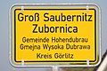 Bilingual sign in German and Upper Sorbian


References
- ^ Gewählte Bürgermeisterinnen und Bürgermeister im Freistaat Sachsen, Stand: 17. Juli 2022, Statistisches Landesamt des Freistaates Sachsen.
- ^ "Einwohnerzahlen nach Gemeinden als Excel-Arbeitsmappe" (XLS) (in German). Statistisches Landesamt des Freistaates Sachsen. 2024.
- ^ a b Verwaltungsverband Diehsa, 31 December 2022
- v
- t
- e
Towns and municipalities in Görlitz (district)
- Bad Muskau/Mužakow
- Beiersdorf
- Bernstadt auf dem Eigen
- Bertsdorf-Hörnitz
- Boxberg/Hamor
- Dürrhennersdorf
- Ebersbach-Neugersdorf
- Gablenz/Jabłońc
- Görlitz
- Groß Düben/Dźěwin
- Großschönau
- Großschweidnitz
- Hähnichen
- Hainewalde
- Herrnhut
- Hohendubrau/Wysoka Dubrawa
- Horka
- Jonsdorf
- Kodersdorf
- Königshain
- Kottmar
- Krauschwitz/Krušwica
- Kreba-Neudorf/Chrjebja-Nowa Wjes
- Lawalde
- Leutersdorf
- Löbau
- Markersdorf
- Mittelherwigsdorf
- Mücka/Mikow
- Neißeaue
- Neusalza-Spremberg
- Niesky
- Oderwitz
- Olbersdorf
- Oppach
- Ostritz
- Oybin
- Quitzdorf am See
- Reichenbach
- Rietschen/Rěčicy
- Rosenbach
- Rothenburg
- Schleife/Slepo
- Schönau-Berzdorf
- Schönbach
- Schöpstal
- Seifhennersdorf
- Trebendorf/Trjebin
- Vierkirchen
- Waldhufen
- Weißkeißel/Wuskidź
- Weißwasser/Běła Woda
- Zittau

Authority control databases | |
|---|---|
| International |
|
| National |
|
 | This Görlitz location article is a stub. You can help Wikipedia by expanding it. |
- v
- t
- e


