National Register of Historic Places listings in Tarrant County, Texas

This is a list of the National Register of Historic Places listings in Tarrant County, Texas.
This is intended to be a complete list of the properties and districts listed on the National Register of Historic Places in Tarrant County, Texas. There are 121 listings on the National Register in the county. Another two properties were once listed but have been removed while a third property has been relocated outside the county. One individually listed property is both a State Antiquities Landmark (SAL) and a Recorded Texas Historic Landmark (RTHL) while an additional property is an SAL. Two districts and 35 individual properties are RTHLs. One district contains additional SALs and RTHLs while six districts hold more RTHLs.
This National Park Service list is complete through NPS recent listings posted May 31, 2024.[1]
Current listings
Map all coordinates using OpenStreetMap
Download coordinates as:
- KML
- GPX (all coordinates)
- GPX (primary coordinates)
- GPX (secondary coordinates)
The locations of National Register properties and districts may be seen in a mapping service provided.[2]
| [3] | Name on the Register[4] | Image | Date listed[5] | Location | City or town | Description |
|---|---|---|---|---|---|---|
| 1 | Allen Chapel AME Church |  | October 18, 1984 (#84000169) | 116 Elm St. 32°45′32″N 97°19′38″W / 32.758889°N 97.327222°W / 32.758889; -97.327222 (Allen Chapel AME Church) | Fort Worth | Recorded Texas Historic Landmark |
| 2 | American Airways Hangar and Administration Building |  | April 16, 2008 (#08000317) | 201 Aviation Wy 32°45′03″N 97°19′56″W / 32.750833°N 97.332222°W / 32.750833; -97.332222 (American Airways Hangar and Administration Building) | Fort Worth | |
| 3 | Neil P. Anderson Building |  | March 8, 1978 (#78002981) | 411 W. 7th St. 32°45′03″N 97°19′56″W / 32.750833°N 97.332222°W / 32.750833; -97.332222 (Neil P. Anderson Building) | Fort Worth | Recorded Texas Historic Landmark |
| 4 | Arlington Post Office |  | March 9, 2000 (#00000188) | 200 W. Main St. 32°44′10″N 97°06′30″W / 32.736111°N 97.108333°W / 32.736111; -97.108333 (Arlington Post Office) | Arlington | Historic and Architectural Resources of Arlington MRA |
| 5 | Stephen F. Austin Elementary School |  | March 10, 1983 (#83003160) | 319 Lipscomb St. 32°44′28″N 97°19′57″W / 32.741111°N 97.3325°W / 32.741111; -97.3325 (Stephen F. Austin Elementary School) | Fort Worth | |
| 6 | Bedford School |  | August 14, 1997 (#97000851) | 2400 School Ln 32°50′46″N 97°08′26″W / 32.846111°N 97.140556°W / 32.846111; -97.140556 (Bedford School) | Bedford | |
| 7 | M. A. Benton House |  | May 22, 1978 (#78002982) | 1730 6th Ave. 32°43′31″N 97°20′24″W / 32.725278°N 97.34°W / 32.725278; -97.34 (M. A. Benton House) | Fort Worth | Recorded Texas Historic Landmark; part of Fairmount-Southside Historic District |
| 8 | Blackstone Hotel |  | February 2, 1984 (#84001961) | 601 Main St. 32°45′13″N 97°19′48″W / 32.753611°N 97.33°W / 32.753611; -97.33 (Blackstone Hotel) | Fort Worth | Recorded Texas Historic Landmark |
| 9 | Botts-Fowler House |  | July 1, 1999 (#99000723) | 115 N. Fourth Ave. 32°33′55″N 97°08′45″W / 32.565278°N 97.145833°W / 32.565278; -97.145833 (Botts-Fowler House) | Mansfield | |
| 10 | Andrew "Cap" and Emma Doughty Bratton House |  | May 22, 2003 (#03000432) | 310 E. Broad St. 32°33′46″N 97°08′19″W / 32.562778°N 97.138611°W / 32.562778; -97.138611 (Andrew "Cap" and Emma Doughty Bratton House) | Mansfield | Historic and Architectural Resources of Mansfield MPS |
| 11 | Bryce Building |  | February 23, 1984 (#84001963) | 909 Throckmorton St. 32°45′04″N 97°19′50″W / 32.7511°N 97.3305°W / 32.7511; -97.3305 (Bryce Building) | Fort Worth | Recorded Texas Historic Landmark |
| 12 | William J. Bryce House |  | March 1, 1984 (#84001965) | 4900 Bryce Ave. 32°44′23″N 97°23′35″W / 32.739722°N 97.393056°W / 32.739722; -97.393056 (William J. Bryce House) | Fort Worth | Recorded Texas Historic Landmark |
| 13 | Buchanan-Hayter-Witherspoon House |  | May 22, 2003 (#03000433) | 306 E. Broad St. 32°33′46″N 97°08′19″W / 32.562778°N 97.138611°W / 32.562778; -97.138611 (Buchanan-Hayter-Witherspoon House) | Mansfield | Historic and Architectural Resources of Mansfield MPS |
| 14 | Burk Burnett Building |  | November 12, 1980 (#80004151) | 500-502 Main St. 32°45′15″N 97°19′51″W / 32.754167°N 97.330833°W / 32.754167; -97.330833 (Burk Burnett Building) | Fort Worth | |
| 15 | Butler Place Historic District |  | August 4, 2011 (#11000514) | Roughly bounded by Luella St., I.M. Terrell Way Cir. M., 19th St. & I-35 West, 32°44′59″N 97°19′01″W / 32.749722°N 97.316944°W / 32.749722; -97.316944 (Butler Place Historic District) | Fort Worth | |
| 16 | Central Handley Historic District |  | January 17, 2002 (#01001472) | Roughly bounded by E. Lancaster Ave., Forest Ave., Kerr St., and Handley Dr. 32°43′58″N 97°13′08″W / 32.732778°N 97.218889°W / 32.732778; -97.218889 (Central Handley Historic District) | Fort Worth | |
| 17 | Lester H. and Mabel Bryant Chorn House |  | May 22, 2003 (#03000434) | 303 E. Broad St. 32°33′48″N 97°08′21″W / 32.563333°N 97.139167°W / 32.563333; -97.139167 (Lester H. and Mabel Bryant Chorn House) | Mansfield | Historic and Architectural Resources of Mansfield MPS |
| 18 | Lily B. Clayton Elementary School |  | January 17, 2017 (#100000504) | 2000 Park Place Ave 32°43′34″N 97°20′56″W / 32.726093°N 97.348762°W / 32.726093; -97.348762 (Lily B. Clayton Elementary School) | Fort Worth | |
| 19 | W.I. Cook Memorial Hospital |  | May 1, 2024 (#100010262) | 1212 West Lancaster Avenue 32°44′48″N 97°20′22″W / 32.7468°N 97.3395°W / 32.7468; -97.3395 (W.I. Cook Memorial Hospital) | Forth Worth | |
| 20 | Cotton Belt Railroad Industrial Historic District |  | September 4, 1997 (#97001109) | Along RR tracks, roughly bounded by Hudgins, Dooley, and Dallas Sts. 32°56′00″N 97°04′42″W / 32.933333°N 97.078333°W / 32.933333; -97.078333 (Cotton Belt Railroad Industrial Historic District) | Grapevine | Historic and Architectural Resources of Grapevine MPS |
| 21 | Eddleman-McFarland House |  | October 18, 1979 (#79003009) | 1110 Penn St. 32°44′50″N 97°20′33″W / 32.747222°N 97.3425°W / 32.747222; -97.3425 (Eddleman-McFarland House) | Fort Worth | Recorded Texas Historic Landmark |
| 22 | Eighth Avenue Historic District |  | November 21, 2006 (#06001065) | Bounded by 8th Ave., Pennsylvania Ave., 9th Ave., and Pruitt St. 32°44′24″N 97°20′39″W / 32.74°N 97.3442°W / 32.74; -97.3442 (Eighth Avenue Historic District) | Fort Worth | Includes Recorded Texas Historic Landmark |
| 23 | Electric Building |  | February 10, 1995 (#95000048) | 410 W. 7th St. 32°45′05″N 97°19′58″W / 32.7514°N 97.3328°W / 32.7514; -97.3328 (Electric Building) | Fort Worth | |
| 24 | Elizabeth Boulevard Historic District |  | November 16, 1979 (#79003010) | 1001-1616 Elizabeth Blvd. 32°42′58″N 97°20′20″W / 32.7161°N 97.3389°W / 32.7161; -97.3389 (Elizabeth Boulevard Historic District) | Fort Worth | |
| 25 | Fair Building |  | July 23, 2020 (#100005350) | 307 West 7th St. 32°45′06″N 97°19′54″W / 32.7517°N 97.3318°W / 32.7517; -97.3318 (Fair Building) | Fort Worth | |
| 26 | Fairmount-Southside Historic District |  | April 5, 1990 (#90000490) May 12, 1999 boundary increase (#99000565) | Roughly bounded by Magnolia, Hemphill, Eighth, and Jessamine 32°43′30″N 97°20′15″W / 32.725°N 97.3375°W / 32.725; -97.3375 (Fairmount-Southside Historic District) | Fort Worth | Includes Recorded Texas Historic Landmarks |
| 27 | Farmers and Mechanics National Bank |  | December 4, 2012 (#12001004) | 714 Main St. 32°45′10″N 97°19′49″W / 32.7527°N 97.3303°W / 32.7527; -97.3303 (Farmers and Mechanics National Bank) | Fort Worth | Now the main headquarters of XTO Energy |
| 28 | Farrington Field and Public Schools Gymnasium |  | February 2, 2022 (#100007403) | 1501 University Dr. and 1400 Foch St. 32°44′43″N 97°21′25″W / 32.7453°N 97.3569°W / 32.7453; -97.3569 (Farrington Field and Public Schools Gymnasium) | Fort Worth | |
| 29 | First Christian Church |  | October 6, 1983 (#83003812) | 612 Throckorton St. 32°45′09″N 97°19′57″W / 32.7525°N 97.3324°W / 32.7525; -97.3324 (First Christian Church) | Fort Worth | |
| 30 | First National Bank Building |  | December 3, 2009 (#09000981) | 711 Houston St. 32°45′09″N 97°19′50″W / 32.7526°N 97.3306°W / 32.7526; -97.3306 (First National Bank Building) | Fort Worth | |
| 31 | Flatiron Building |  | March 31, 1971 (#71000964) | 1000 Houston St. 32°45′01″N 97°19′46″W / 32.7503°N 97.3294°W / 32.7503; -97.3294 (Flatiron Building) | Fort Worth | Recorded Texas Historic Landmark |
| 32 | Fort Worth Botanic Garden |  | January 29, 2009 (#08001400) | 3220 Botanic Garden Blvd. 32°44′26″N 97°21′46″W / 32.7405°N 97.3627°W / 32.7405; -97.3627 (Fort Worth Botanic Garden) | Fort Worth | |
| 33 | Fort Worth Club Building – 1916 |  | February 12, 1998 (#98000102) | 608-610 Main St. 32°45′12″N 97°19′51″W / 32.7533°N 97.3307°W / 32.7533; -97.3307 (Fort Worth Club Building – 1916) | Fort Worth | |
| 34 | Fort Worth Elks Lodge 124 |  | February 16, 1984 (#84001969) | 512 W. 4th St. 32°45′10″N 97°20′05″W / 32.7528°N 97.3347°W / 32.7528; -97.3347 (Fort Worth Elks Lodge 124) | Fort Worth | Recorded Texas Historic Landmark |
| 35 | Fort Worth High School |  | December 12, 2002 (#02001515) | 1015 S. Jennings Ave. 32°44′08″N 97°19′46″W / 32.7356°N 97.3294°W / 32.7356; -97.3294 (Fort Worth High School) | Fort Worth | |
| 36 | Fort Worth National Bank |  | September 9, 2022 (#100008197) | 115 West 7th St. 32°45′09″N 97°19′49″W / 32.7524°N 97.3303°W / 32.7524; -97.3303 (Fort Worth National Bank) | Fort Worth | |
| 37 | Fort Worth Public Market |  | January 5, 1984 (#84001981) | 1400 Henderson St. 32°44′39″N 97°20′16″W / 32.7442°N 97.3378°W / 32.7442; -97.3378 (Fort Worth Public Market) | Fort Worth | Recorded Texas Historic Landmark |
| 38 | Fort Worth Recreation Building |  | June 13, 2014 (#14000343) | 215 West Vickery Boulevard 32°44′36″N 97°19′39″W / 32.7434°N 97.3274°W / 32.7434; -97.3274 (Fort Worth Recreation Building) | Fort Worth | |
| 39 | Fort Worth Stockyards Historic District |  | June 29, 1976 (#76002067) | Roughly bounded by 23rd, Houston, and 28th Sts., and railroad 32°47′25″N 97°20′46″W / 32.7903°N 97.3461°W / 32.7903; -97.3461 (Fort Worth Stockyards Historic District) | Fort Worth | Includes State Antiquities Landmarks, Recorded Texas Historic Landmark |
| 40 | Fort Worth US Courthouse |  | April 25, 2001 (#01000437) | 501 W. 10th St. 32°44′56″N 97°20′02″W / 32.7489°N 97.3339°W / 32.7489; -97.3339 (Fort Worth US Courthouse) | Fort Worth | |
| 41 | Fort Worth Warehouse and Transfer Company Building |  | March 27, 2013 (#13000126) | 201 S. Calhoun St. 32°44′33″N 97°19′25″W / 32.7424°N 97.3236°W / 32.7424; -97.3236 (Fort Worth Warehouse and Transfer Company Building) | Fort Worth | |
| 42 | Fortune Arms Apartments |  | June 7, 2016 (#16000353) | 601 W. 1st St. 32°45′15″N 97°20′11″W / 32.7543°N 97.3363°W / 32.7543; -97.3363 (Fortune Arms Apartments) | Fort Worth | [6] |
| 43 | Eldred W. Foster House |  | August 28, 2012 (#12000589) | 9608 Heron Dr. 32°47′43″N 97°29′10″W / 32.7954°N 97.4861°W / 32.7954; -97.4861 (Eldred W. Foster House) | Fort Worth | |
| 44 | Grand Avenue Historic District |  | March 1, 1990 (#90000337) | Roughly Grand Ave. from Northside to Park 32°46′20″N 97°21′38″W / 32.772222°N 97.360556°W / 32.772222; -97.360556 (Grand Avenue Historic District) | Fort Worth | |
| 45 | Grapevine Commercial Historic District | 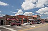 | March 9, 1992 (#92000097) May 16, 1997 boundary increase (#97000444) December 19, 2002 boundary increase (#02001569) | 300-530 S. Main St. 32°56′12″N 97°04′43″W / 32.936667°N 97.078611°W / 32.936667; -97.078611 (Grapevine Commercial Historic District) | Grapevine | Includes Recorded Texas Historic Landmark; Historic and Architectural Resources of Grapevine MPS |
| 46 | James E. Guinn School |  | May 12, 1998 (#98000429) | 1200 South Freeway 32°43′54″N 97°19′15″W / 32.731667°N 97.320833°W / 32.731667; -97.320833 (James E. Guinn School) | Fort Worth | |
| 47 | Gulf, Colorado and Santa Fe Railroad Passenger Station |  | October 15, 1970 (#70000760) | 1601 Jones St. 32°44′57″N 97°19′26″W / 32.749167°N 97.323889°W / 32.749167; -97.323889 (Gulf, Colorado and Santa Fe Railroad Passenger Station) | Fort Worth | Recorded Texas Historic Landmark |
| 48 | Hamilton Apartments | 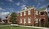 | August 29, 2018 (#100002850) | 2837 Hemphill St. 32°42′36″N 97°19′53″W / 32.709896°N 97.331284°W / 32.709896; -97.331284 (Hamilton Apartments) | Fort Worth | |
| 49 | Henderson Street Bridge | 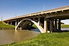 | March 21, 2011 (#11000128) | Henderson Street at the Clear Fork of the Trinity River 32°45′29″N 97°20′32″W / 32.757986°N 97.342222°W / 32.757986; -97.342222 (Henderson Street Bridge) | Fort Worth | Historic Bridges of Texas, 1866-1945 MPS |
| 50 | Heritage Park Plaza |  | May 10, 2010 (#10000253) | W Bluff St at Main St 32°45′29″N 97°20′04″W / 32.758056°N 97.334306°W / 32.758056; -97.334306 (Heritage Park Plaza) | Fort Worth | |
| 51 | Alexander Hogg School |  | December 12, 2002 (#02001512) | 900 St. Louis Ave. 32°44′13″N 97°19′43″W / 32.736944°N 97.328611°W / 32.736944; -97.328611 (Alexander Hogg School) | Fort Worth | |
| 52 | Hotel Texas |  | July 3, 1979 (#79003011) November 26, 2014 boundary increase (#14000966)[7] | 815 Main St. and 815 Commerece St. 32°45′09″N 97°19′45″W / 32.7525°N 97.329167°W / 32.7525; -97.329167 (Hotel Texas) | Fort Worth | Recorded Texas Historic Landmark |
| 53 | Hutcheson-Smith House |  | August 2, 1984 (#84001993) | 312 N. Oak St. 32°44′24″N 97°06′33″W / 32.74°N 97.109167°W / 32.74; -97.109167 (Hutcheson-Smith House) | Arlington | Recorded Texas Historic Landmark; part of Old Town Historic District |
| 54 | Inspiration Point Shelter House |  | March 31, 2014 (#14000105) | Roughly 250 yds. S. of 2400 blk. of Roberts Cut Off Rd. 32°47′41″N 97°24′36″W / 32.794717°N 97.409917°W / 32.794717; -97.409917 (Inspiration Point Shelter House) | Fort Worth | |
| 55 | Jennings-Vickery Historic District |  | February 21, 2017 (#100000674) | Roughly bounded by W. Vickery Blvd., St. Louis & W. Daggett Aves., Hemphill St. & Jennings Ave. underpass 32°44′35″N 97°20′02″W / 32.742939°N 97.333984°W / 32.742939; -97.333984 (Jennings-Vickery Historic District) | Fort Worth | |
| 56 | Johnson-Elliott House | 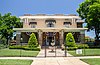 | May 10, 1984 (#84001996) | 3 Chase Ct. 32°43′31″N 97°19′54″W / 32.725278°N 97.331667°W / 32.725278; -97.331667 (Johnson-Elliott House) | Fort Worth | Recorded Texas Historic Landmark; part of Fairmount-Southside Historic District |
| 57 | Katy Freight Depot |  | February 7, 2020 (#100004969) | 100 South Jones St. 32°42′10″N 97°19′24″W / 32.7029°N 97.3232°W / 32.7029; -97.3232 (Katy Freight Depot) | Fort Worth | |
| 58 | Knights of Pythias Building | 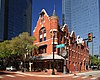 | April 28, 1970 (#70000761) | 315 Main St. 32°45′19″N 97°19′52″W / 32.755278°N 97.331111°W / 32.755278; -97.331111 (Knights of Pythias Building) | Fort Worth | Recorded Texas Historic Landmark |
| 59 | Elizabeth and Jack Knight House |  | May 17, 2021 (#100006521) | 2811 Simondale Dr. 32°42′39″N 97°22′19″W / 32.7108°N 97.3720°W / 32.7108; -97.3720 (Elizabeth and Jack Knight House) | Fort Worth | |
| 60 | Kress Building |  | April 4, 2007 (#07000266) | 604 Main St. 32°45′12″N 97°19′52″W / 32.753333°N 97.331111°W / 32.753333; -97.331111 (Kress Building) | Fort Worth | |
| 61 | Leuda-May Historic District |  | March 30, 2005 (#05000240) | 301-311 W. Leuda and 805-807 May Sts. 32°44′14″N 97°19′44″W / 32.737222°N 97.328889°W / 32.737222; -97.328889 (Leuda-May Historic District) | Fort Worth | |
| 62 | Ralph Sandiford and Julia Boisseau Man House |  | May 22, 2003 (#03000435) | 604 W. Broad St. 32°33′55″N 97°08′57″W / 32.565297°N 97.149072°W / 32.565297; -97.149072 (Ralph Sandiford and Julia Boisseau Man House) | Mansfield | Historic and Architectural Resources of Mansfield MPS |
| 63 | Marine Commercial Historic District |  | February 9, 2001 (#01000102) | Roughly defined by N. Main St., bet. N. Side Dr. and N. 14th St. 32°46′39″N 97°20′46″W / 32.7775°N 97.346111°W / 32.7775; -97.346111 (Marine Commercial Historic District) | Fort Worth | |
| 64 | Markeen Apartments | 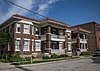 | May 2, 2001 (#01000470) | 210-14 St. Louis Ave. and 406-10 W. Daggett Ave. 32°44′31″N 97°19′41″W / 32.741944°N 97.328056°W / 32.741944; -97.328056 (Markeen Apartments) | Fort Worth | Part of Jennings-Vickery Historic District |
| 65 | Marrow Bone Spring Archeological Site |  | November 21, 1978 (#78002980) | Vandergriff Park 32°44′10″N 97°06′33″W / 32.736111°N 97.109167°W / 32.736111; -97.109167 (Marrow Bone Spring Archeological Site) | Arlington | |
| 66 | Masonic Widows and Orphans Home Historic District | 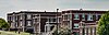 | January 28, 1992 (#91002022) | Roughly bounded by E. Berry St., Mitchell Blvd., Vaughn St., Wichita St. and Glen Garden Dr 32°42′33″N 97°17′00″W / 32.709167°N 97.283333°W / 32.709167; -97.283333 (Masonic Widows and Orphans Home Historic District) | Fort Worth | |
| 67 | Masonic Temple | 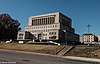 | June 19, 2017 (#100001227) | 1100 Henderson St. 32°44′50″N 97°20′18″W / 32.747255°N 97.338380°W / 32.747255; -97.338380 (Masonic Temple) | Fort Worth | Recorded Texas Historic Landmark |
| 68 | Miller Manufacturing Company Building |  | October 28, 2010 (#10000865) | 311 Bryan Ave. 32°44′28″N 97°19′29″W / 32.741111°N 97.324722°W / 32.741111; -97.324722 (Miller Manufacturing Company Building) | Fort Worth | |
| 69 | Montgomery Ward and Company Building | 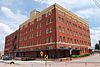 | November 19, 1998 (#98001415) | 801 Grove St. 32°45′14″N 97°19′34″W / 32.753889°N 97.326111°W / 32.753889; -97.326111 (Montgomery Ward and Company Building) | Fort Worth | |
| 70 | Morning Chapel Colored Methodist Episcopal Church |  | August 27, 1999 (#99001049) | 901 E. Third St. 32°45′30″N 97°19′32″W / 32.758283°N 97.325613°W / 32.758283; -97.325613 (Morning Chapel Colored Methodist Episcopal Church) | Fort Worth | |
| 71 | Thomas J. and Elizabeth Nash Farm | 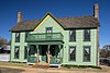 | October 28, 2010 (#10000866) | 626 Ball St. 32°56′03″N 97°05′09″W / 32.934167°N 97.085833°W / 32.934167; -97.085833 (Thomas J. and Elizabeth Nash Farm) | Grapevine | Recorded Texas Historic Landmark |
| 72 | Near Southeast Historic District |  | April 26, 2002 (#02000405) | Roughly bounded by New York Ave., E. Terrell Ave., former I&GN Railway, Verbena St., and N side of E. Terrell Ave, 32°43′58″N 97°14′15″W / 32.732778°N 97.2375°W / 32.732778; -97.2375 (Near Southeast Historic District) | Fort Worth | Includes Recorded Texas Historic Landmark |
| 73 | North Fort Worth High School |  | February 2, 1995 (#94001627) | 600 Park St. 32°46′52″N 97°21′24″W / 32.781111°N 97.356667°W / 32.781111; -97.356667 (North Fort Worth High School) | Fort Worth | |
| 74 | Oakhurst Historic District |  | February 24, 2010 (#10000051) | Roughly bounded by Yucca Ave., Sylvania Ave., Watauga Ave., and Oakhurst Scenic Dr. 32°47′08″N 97°18′48″W / 32.785556°N 97.313333°W / 32.785556; -97.313333 (Oakhurst Historic District) | Fort Worth | Historic Residential Suburbs in the United States, 1830-1960 MPS |
| 75 | Oakwood Cemetery Historic District |  | May 29, 2018 (#100002473) | 701 Grand Ave. 32°46′10″N 97°20′55″W / 32.769542°N 97.348611°W / 32.769542; -97.348611 (Oakwood Cemetery Historic District) | Fort Worth | Recorded Texas Historic Landmark and includes another |
| 76 | Oil & Gas Building |  | January 25, 2024 (#100009864) | 309 W. 7th Street 32°45′06″N 97°19′54″W / 32.7517°N 97.3318°W / 32.7517; -97.3318 (Oil & Gas Building) | Fort Worth | |
| 77 | Old Town Historic District |  | March 23, 2000 (#00000247) | Roughly bounded by Sanford, Elm, North, Prairie and Oak Sts. 32°44′27″N 97°06′05″W / 32.740833°N 97.101389°W / 32.740833; -97.101389 (Old Town Historic District) | Arlington | Includes Recorded Texas Historic Landmarks; Historic and Architectural Resources of Arlington MRA |
| 78 | Original Town Residential Historic District |  | July 10, 1998 (#98000736) | Roughly bounded by Texas, Austin, Hudgins and Jenkins Sts. 32°56′11″N 97°04′28″W / 32.936389°N 97.074444°W / 32.936389; -97.074444 (Original Town Residential Historic District) | Grapevine | Historic and Architectural Resources of Grapevine MPS |
| 79 | Our Lady of Victory Academy |  | August 20, 2004 (#04000886) | 801 W. Shaw St. 32°42′11″N 97°19′59″W / 32.703056°N 97.333056°W / 32.703056; -97.333056 (Our Lady of Victory Academy) | Fort Worth | |
| 80 | Our Mother of Mercy Catholic Church and Parsonage |  | July 22, 1999 (#99000882) | 1100 and 1104 Evans Ave. 32°43′57″N 97°19′05″W / 32.7325°N 97.318056°W / 32.7325; -97.318056 (Our Mother of Mercy Catholic Church and Parsonage) | Fort Worth | Part of Near Southeast Historic District |
| 81 | Our Mother of Mercy School | 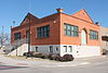 | June 15, 2006 (#06000510) | 801 Verbena St. 32°44′06″N 97°19′08″W / 32.735°N 97.318889°W / 32.735; -97.318889 (Our Mother of Mercy School) | Fort Worth | Part of Near Southeast Historic District |
| 82 | Fountain G. and Mary Oxsheer House |  | July 24, 2017 (#100001378) | 1119 Pennsylvania Ave. 32°44′17″N 97°20′14″W / 32.738129°N 97.337215°W / 32.738129; -97.337215 (Fountain G. and Mary Oxsheer House) | Fort Worth | |
| 83 | Paddock Viaduct |  | March 15, 1976 (#76002068) | Main St. 32°45′33″N 97°20′04″W / 32.759278°N 97.334411°W / 32.759278; -97.334411 (Paddock Viaduct) | Fort Worth | State Antiquities Landmark |
| 84 | Parker-Browne Company Building |  | June 3, 2015 (#15000337) | 1212 E. Lancaster Ave. 32°44′45″N 97°19′00″W / 32.745891°N 97.316580°W / 32.745891; -97.316580 (Parker-Browne Company Building) | Fort Worth | |
| 85 | Petroleum Building |  | December 3, 2009 (#09000982) | 210 W. 6th St. 32°45′10″N 97°19′54″W / 32.752828°N 97.331786°W / 32.752828; -97.331786 (Petroleum Building) | Fort Worth | |
| 86 | Pioneers Rest Cemetery |  | January 27, 2021 (#100006072) | 600 Samuels Ave. 32°45′56″N 97°19′43″W / 32.765658°N 97.328589°W / 32.765658; -97.328589 (Pioneers Rest Cemetery) | Fort Worth | |
| 87 | Pollock-Capps House |  | June 19, 1972 (#72001372) | 1120 Penn St. 32°44′49″N 97°20′33″W / 32.7469°N 97.3425°W / 32.7469; -97.3425 (Pollock-Capps House) | Fort Worth | Recorded Texas Historic Landmark |
| 88 | Dr. Arvel and Faye Ponton House |  | November 29, 2006 (#06001085) | 1208 Mistletoe Dr. 32°43′50″N 97°21′22″W / 32.7306°N 97.3561°W / 32.7306; -97.3561 (Dr. Arvel and Faye Ponton House) | Fort Worth | Recorded Texas Historic Landmark |
| 89 | Ridglea Theatre |  | December 30, 2011 (#11000982) | 6025-6033 Camp Bowie Rd. & 3309 Winthrop Ave. 32°43′44″N 97°24′52″W / 32.729°N 97.4145°W / 32.729; -97.4145 (Ridglea Theatre) | Fort Worth | |
| 90 | Riverside Baptist Church |  | September 23, 2020 (#100005603) | 3111 Race St. 32°46′23″N 97°18′09″W / 32.7731°N 97.3025°W / 32.7731; -97.3025 (Riverside Baptist Church) | Fort Worth | |
| 91 | Riverside Public School |  | December 30, 1999 (#99001624) | 2629 LaSalle St. 32°45′29″N 97°18′19″W / 32.7581°N 97.3053°W / 32.7581; -97.3053 (Riverside Public School) | Fort Worth | |
| 92 | Will Rogers Memorial Center |  | March 22, 2016 (#16000122) | 3401 W. Lancaster Ave. 32°44′46″N 97°21′59″W / 32.7462°N 97.3663°W / 32.7462; -97.3663 (Will Rogers Memorial Center) | Fort Worth | |
| 93 | Rogers-O'Daniel House |  | July 5, 1985 (#85001484) | 2230 Warner Rd. 32°42′35″N 97°20′50″W / 32.7097°N 97.3472°W / 32.7097; -97.3472 (Rogers-O'Daniel House) | Fort Worth | Recorded Texas Historic Landmark |
| 94 | Saint James Second Street Baptist Church |  | July 22, 1999 (#99000883) | 210 Harding St. 32°45′34″N 97°19′28″W / 32.7594°N 97.3244°W / 32.7594; -97.3244 (Saint James Second Street Baptist Church) | Fort Worth | Recorded Texas Historic Landmark |
| 95 | St. Mary of the Assumption Church |  | May 10, 1984 (#84001998) | 501 W. Magnolia Ave. 32°43′49″N 97°19′48″W / 32.7303°N 97.33°W / 32.7303; -97.33 (St. Mary of the Assumption Church) | Fort Worth | Recorded Texas Historic Landmark |
| 96 | St. Patrick Cathedral Complex |  | January 7, 1985 (#85000074) | 1206 Throckmorton 32°44′56″N 97°19′46″W / 32.7489°N 97.3294°W / 32.7489; -97.3294 (St. Patrick Cathedral Complex) | Fort Worth | Includes Recorded Texas Historic Landmarks |
| 97 | Sanger Brothers Building |  | June 3, 1994 (#94000542) | 410-412 Houston St. 32°45′15″N 97°19′55″W / 32.7542°N 97.3319°W / 32.7542; -97.3319 (Sanger Brothers Building) | Fort Worth | |
| 98 | Sanger Brothers Building |  | December 10, 2014 (#14001035) | 515 Houston St. 32°45′13″N 97°19′53″W / 32.7537°N 97.3314°W / 32.7537; -97.3314 (Sanger Brothers Building) | Fort Worth | |
| 99 | Marshall R. Sanguinet House |  | June 7, 1983 (#83003162) | 4729 Collinwood Ave. 32°44′14″N 97°23′26″W / 32.7372°N 97.3906°W / 32.7372; -97.3906 (Marshall R. Sanguinet House) | Fort Worth | Recorded Texas Historic Landmark |
| 100 | J.L. Sealy Building |  | August 20, 2013 (#13000612) | 801 S. Main St. 32°44′11″N 97°19′33″W / 32.7364°N 97.3257°W / 32.7364; -97.3257 (J.L. Sealy Building) | Fort Worth | |
| 101 | Shannon's Funeral Home |  | July 23, 2018 (#100002699) | 2717 Ave. B 32°44′04″N 97°17′10″W / 32.7345°N 97.2862°W / 32.7345; -97.2862 (Shannon's Funeral Home) | Fort Worth | |
| 102 | Thomas and Marjorie Shaw House |  | August 22, 1995 (#95001029) | 2404 Medford Ct. E. 32°43′03″N 97°21′24″W / 32.7175°N 97.3567°W / 32.7175; -97.3567 (Thomas and Marjorie Shaw House) | Fort Worth | Recorded Texas Historic Landmark |
| 103 | Sinclair Building |  | January 7, 1992 (#91001913) | 512 Main St. 32°45′14″N 97°19′51″W / 32.7539°N 97.3308°W / 32.7539; -97.3308 (Sinclair Building) | Fort Worth | Recorded Texas Historic Landmark |
| 104 | South Center Street Historic District |  | May 1, 2003 (#03000334) | 500-600 blocks of S. Center St. 32°43′53″N 97°06′24″W / 32.7314°N 97.1067°W / 32.7314; -97.1067 (South Center Street Historic District) | Arlington | |
| 105 | South Main St. Historic District |  | December 3, 2009 (#09000984) | 104, 108, 126, & 200 blocks of S. Main St. 32°44′33″N 97°19′33″W / 32.7425°N 97.3259°W / 32.7425; -97.3259 (South Main St. Historic District) | Fort Worth | |
| 106 | South Side Masonic Lodge No. 1114 |  | January 3, 1985 (#85000048) | 1301 W. Magnolia 32°43′48″N 97°20′16″W / 32.73°N 97.3378°W / 32.73; -97.3378 (South Side Masonic Lodge No. 1114) | Fort Worth | Part of Fairmount-Southside Historic District |
| 107 | Tabernacle Baptist Church |  | November 30, 1999 (#99001451) | 1801 Evans Ave. 32°43′29″N 97°19′03″W / 32.7247°N 97.3175°W / 32.7247; -97.3175 (Tabernacle Baptist Church) | Fort Worth | |
| 108 | Tarrant County Courthouse |  | October 15, 1970 (#70000762) | Bounded by Houston, Belknap, Weatherford, and Commerce Sts. 32°45′26″N 97°19′58″W / 32.7572°N 97.3328°W / 32.7572; -97.3328 (Tarrant County Courthouse) | Fort Worth | State Antiquities Landmark, Recorded Texas Historic Landmark |
| 109 | Texas and Pacific Terminal Complex |  | May 26, 1978 (#78002983) | Lancaster and Throckmorton Sts. 32°44′45″N 97°19′43″W / 32.745833°N 97.328611°W / 32.745833; -97.328611 (Texas and Pacific Terminal Complex) | Fort Worth | Recorded Texas Historic Landmark |
| 110 | Texas Garden Clubs, Inc., Headquarters |  | March 21, 2011 (#11000136) | 3111 Old Garden Rd. 32°44′09″N 97°21′52″W / 32.735764°N 97.364583°W / 32.735764; -97.364583 (Texas Garden Clubs, Inc., Headquarters) | Fort Worth | Recorded Texas Historic Landmark |
| 111 | US Post Office |  | April 15, 1985 (#85000855) | 251 W. Lancaster Ave.[8] 32°44′47″N 97°19′46″W / 32.7464°N 97.3294°W / 32.7464; -97.3294 (US Post Office) | Fort Worth | Recorded Texas Historic Landmark |
| 112 | Van Zandt Cottage |  | December 4, 2012 (#12001005) | 2900 Crestline Rd. 32°44′39″N 97°21′32″W / 32.74406°N 97.35879°W / 32.74406; -97.35879 (Van Zandt Cottage) | Fort Worth | Recorded Texas Historic Landmark |
| 113 | Vandergriff Building |  | July 26, 2010 (#10000500) | 100 E Division St. 32°44′20″N 97°06′24″W / 32.738819°N 97.106528°W / 32.738819; -97.106528 (Vandergriff Building) | Arlington | |
| 114 | Vaught House |  | August 10, 2005 (#05000864) | 718 W. Abram St. 32°44′06″N 97°06′56″W / 32.735°N 97.115556°W / 32.735; -97.115556 (Vaught House) | Arlington | |
| 115 | W. T. Waggoner Building |  | July 10, 1979 (#79003012) | 810 Houston St. 32°45′05″N 97°19′49″W / 32.751389°N 97.330278°W / 32.751389; -97.330278 (W. T. Waggoner Building) | Fort Worth | |
| 116 | Wallace-Hall House |  | May 22, 2003 (#03000436) | 210 S. Main St. 32°33′42″N 97°08′32″W / 32.561667°N 97.142222°W / 32.561667; -97.142222 (Wallace-Hall House) | Mansfield | Historic and Architectural Resources of Mansfield MPS |
| 117 | Roy A. and Gladys Westbrook House |  | January 8, 2009 (#08001300) | 2232 Winton Terrace W. 32°43′15″N 97°21′35″W / 32.720792°N 97.359631°W / 32.720792; -97.359631 (Roy A. and Gladys Westbrook House) | Fort Worth | Recorded Texas Historic Landmark |
| 118 | Westover Manor |  | December 15, 1988 (#88002709) | 8 Westover Rd. 32°44′31″N 97°24′14″W / 32.741944°N 97.403889°W / 32.741944; -97.403889 (Westover Manor) | Westover Hills | Recorded Texas Historic Landmark |
| 119 | Wharton-Scott House |  | April 14, 1975 (#75002003) | 1509 Pennsylvania Ave. 32°44′16″N 97°20′32″W / 32.737778°N 97.342222°W / 32.737778; -97.342222 (Wharton-Scott House) | Fort Worth | Recorded Texas Historic Landmark |
| 120 | The Woman's Club of Fort Worth |  | April 10, 2017 (#100000862) | N. side, 1300 blk. Pennsylvania Ave. 32°26′31″N 97°12′09″W / 32.441995°N 97.202424°W / 32.441995; -97.202424 (The Woman's Club of Fort Worth) | Fort Worth | Includes Recorded Texas Historic Landmarks |
| 121 | F. W. Woolworth Building |  | November 25, 1994 (#94001359) | 501 Houston St. 32°45′12″N 97°19′52″W / 32.753333°N 97.331111°W / 32.753333; -97.331111 (F. W. Woolworth Building) | Fort Worth |
Former listings
| [3] | Name on the Register | Image | Date listed | Date removed | Location | City or town | Description |
|---|---|---|---|---|---|---|---|
| 1 | Buck Oaks Farm | Upload image | July 6, 1987 (#87000995) | May 28, 2004 | 6312 White Settlement Road 32°45′34″N 97°25′29″W / 32.759320°N 97.424848°W / 32.759320; -97.424848 (Buck Oaks Farm) | Westworth | |
| 2 | M. G. Ellis School | Upload image | May 28, 1983 (#83003161) | May 28, 1986 | 213 NE. 14th St. 32°46′51″N 97°20′49″W / 32.780719°N 97.346953°W / 32.780719; -97.346953 (M. G. Ellis School) | Fort Worth | Destroyed by fire on January 28, 1986.[9] |
| 3 | Texas & Pacific Steam Locomotive No. 610 |  | March 25, 1977 (#77001477) | None | Park Road 70 31°44′28″N 95°34′16″W / 31.74118°N 95.5712°W / 31.74118; -95.5712 (Texas & Pacific Steam Locomotive No. 610) | Palestine | Relocated to the Texas State Railroad in Palestine, Texas. |
See also
 National Register of Historic Places portal
 Texas portal


- National Register of Historic Places listings in Texas
- Recorded Texas Historic Landmarks in Tarrant County
References
- ^ National Park Service, United States Department of the Interior, "National Register of Historic Places: Weekly List Actions", retrieved May 31, 2024.
- ^ The latitude and longitude information provided in this table was derived originally from the National Register Information System, which has been found to be fairly accurate for about 99% of listings. Some locations in this table may have been corrected to current GPS standards.
- ^ a b Numbers represent an alphabetical ordering by significant words. Various colorings, defined here, differentiate National Historic Landmarks and historic districts from other NRHP buildings, structures, sites or objects.
- ^ "National Register Information System". National Register of Historic Places. National Park Service. November 2, 2013.
- ^ The eight-digit number below each date is the number assigned to each location in the National Register Information System database, which can be viewed by clicking the number.
- ^ "Archived copy" (PDF). Archived from the original (PDF) on 2016-03-04. Retrieved 2016-06-18.
{{cite web}}: CS1 maint: archived copy as title (link) - ^ "Hotel Texas (Boundary Increase)". National Park Service. Retrieved June 3, 2018.
- ^ Address based on USPS website. Accessed April 11, 2016.
- ^ "Fire guts old school on N. Side". Fort Worth Star-Telegram. January 29, 1986. p. 19A. Retrieved August 30, 2022 – via Newspapers.com.
External links
![]() Media related to National Register of Historic Places in Tarrant County, Texas at Wikimedia Commons
Media related to National Register of Historic Places in Tarrant County, Texas at Wikimedia Commons
- v
- t
- e
by county
- Anderson
- Andrews
- Angelina
- Aransas
- Archer
- Armstrong
- Atascosa
- Austin
- Bailey
- Bandera
- Bastrop
- Baylor
- Bee
- Bell
- Bexar
- Blanco
- Borden
- Bosque
- Bowie
- Brazoria
- Brazos
- Brewster
- Briscoe
- Brooks
- Brown
- Burleson
- Burnet
- Caldwell
- Calhoun
- Callahan
- Cameron
- Camp
- Carson
- Cass
- Castro
- Chambers
- Cherokee
- Childress
- Clay
- Cochran
- Coke
- Coleman
- Collin
- Collingsworth
- Colorado
- Comal
- Comanche
- Concho
- Cooke
- Coryell
- Cottle
- Crane
- Crockett
- Crosby
- Culberson
- Dallam
- Dallas
- Dawson
- Deaf Smith
- Delta
- Denton
- DeWitt
- Dickens
- Dimmit
- Donley
- Duval
- Eastland
- Ector
- Edwards
- El Paso
- Ellis
- Erath
- Falls
- Fannin
- Fayette
- Fisher
- Floyd
- Foard
- Fort Bend
- Franklin
- Freestone
- Frio
- Gaines
- Galveston
- Garza
- Gillespie
- Glasscock
- Goliad
- Gonzales
- Gray
- Grayson
- Gregg
- Grimes
- Guadalupe
- Hale
- Hall
- Hamilton
- Hansford
- Hardeman
- Hardin
- Harris
- Harrison
- Hartley
- Haskell
- Hays
- Hemphill
- Henderson
- Hidalgo
- Hill
- Hockley
- Hood
- Hopkins
- Houston
- Howard
- Hudspeth
- Hunt
- Hutchinson
- Irion
- Jack
- Jackson
- Jasper
- Jeff Davis
- Jefferson
- Jim Hogg
- Jim Wells
- Johnson
- Jones
- Karnes
- Kaufman
- Kendall
- Kenedy
- Kent
- Kerr
- Kimble
- King
- Kinney
- Kleberg
- Knox
- La Salle
- Lamar
- Lamb
- Lampasas
- Lavaca
- Lee
- Leon
- Liberty
- Limestone
- Lipscomb
- Live Oak
- Llano
- Loving
- Lubbock
- Lynn
- Madison
- Marion
- Martin
- Mason
- Matagorda
- Maverick
- McCulloch
- McLennan
- McMullen
- Medina
- Menard
- Midland
- Milam
- Mills
- Mitchell
- Montague
- Montgomery
- Moore
- Morris
- Motley
- Nacogdoches
- Navarro
- Newton
- Nolan
- Nueces
- Ochiltree
- Oldham
- Orange
- Palo Pinto
- Panola
- Parker
- Parmer
- Pecos
- Polk
- Potter
- Presidio
- Rains
- Randall
- Reagan
- Real
- Red River
- Reeves
- Refugio
- Roberts
- Robertson
- Rockwall
- Runnels
- Rusk
- Sabine
- San Augustine
- San Jacinto
- San Patricio
- San Saba
- Schleicher
- Scurry
- Shackelford
- Shelby
- Sherman
- Smith
- Somervell
- Starr
- Stephens
- Sterling
- Stonewall
- Sutton
- Swisher
- Tarrant
- Taylor
- Terrell
- Terry
- Throckmorton
- Titus
- Tom Green
- Travis
- Trinity
- Tyler
- Upshur
- Upton
- Uvalde
- Val Verde
- Van Zandt
- Victoria
- Walker
- Waller
- Ward
- Washington
- Webb
- Wharton
- Wheeler
- Wichita
- Wilbarger
- Willacy
- Williamson
- Wilson
- Winkler
- Wise
- Wood
- Yoakum
- Young
- Zapata
- Zavala

Municipalities and communities of Tarrant County, Texas, United States | ||
|---|---|---|
County seat: Fort Worth | ||
| Cities |
|  |
| Towns | ||
| CDPs | ||
| Other communities | ||
| Historical communities | ||
| Ghost towns | ||
| Footnotes | ‡ This populated place also has portions in an adjacent county or counties | |
| ||


