Pálfa
Place in Tolna, Hungary

Coat of arms
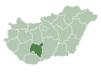
 Hungary
 (2011)
7042
Pálfa is a village in Tolna county, Hungary.
- v
- t
- e
Towns and villages of Paks District
- Dunaföldvár
- Paks (district seat)

- Nagydorog
| ||
|---|---|---|
| City with county rights |
|   |
| Towns | ||
| Large villages | ||
| Villages |
| |
| Other topics |
| |
 | This Tolna location article is a stub. You can help Wikipedia by expanding it. |
- v
- t
- e


