Vahto
Former municipality in Western Finland, Finland

Coat of arms
(2003)
Vahto (Finnish pronunciation: [ˈʋɑhto]) is a former municipality of Finland. It was consolidated with Rusko on January 1, 2009.
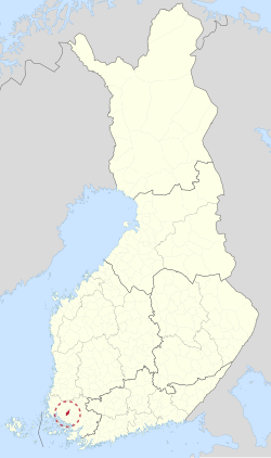
It is located in the province of Western Finland and is part of the Southwest Finland region. The municipality had a population of 1,876 (2004-12-31) and covered an area of 77.10 km2 of which 0.02 km2 is water. The population density was 24.34 inhabitants per km2.
Vahto was one of the 18 municipalities in the Turku region, and due to its close proximity to the center of Turku (about 20 km), it may also be considered part of the Turku metropolitan area. In the north, Vahto shared a common boundary mark with seven other municipalities. This famous site, called Kuhankuono in Finnish, is also a pre-historical border mark between Southwest Finland and the other Finnish provinces.
The municipality was unilingually Finnish.
External links
 Media related to Vahto at Wikimedia Commons
- Municipality of Vahto – Official site (in Finnish) (archived)
- v
- t
- e

- Alastaro
- Angelniemi
- Askainen
- Dragsfjärd
- Halikko
- Hitis
- Houtskär
- Iniö
- Kakskerta
- Kalanti
- Karinainen
- Karjala
- Karuna
- Kimito
- Kiikala
- Kisko
- Korpo
- Kuusisto
- Kuusjoki
- Lemu
- Loimaan kunta
- Lokalahti
- Maaria
- Mellilä
- Merimasku
- Metsämaa
- Mietoinen
- Muurla
- Naantalin maalaiskunta
- Nagu
- Paattinen
- Pargas landskommun
- Perniö
- Pertteli
- Piikkiö
- Pyhämaa
- Rymättylä
- Särkisalo
- Somerniemi
- Suomusjärvi
- Tarvasjoki
- Uskela
- Uudenkaupungin maalaiskunta
- Vahto
- Västanfjärd
- Velkua
- Yläne
| Authority control databases: National |
|
|---|
 | This Western Finland location article is a stub. You can help Wikipedia by expanding it. |
- v
- t
- e


